

Breitenbach Saulueg Kundler Klamm
A cycling route starting in Breitenbach am Inn, Tyrol, Austria.
Overview
About this route
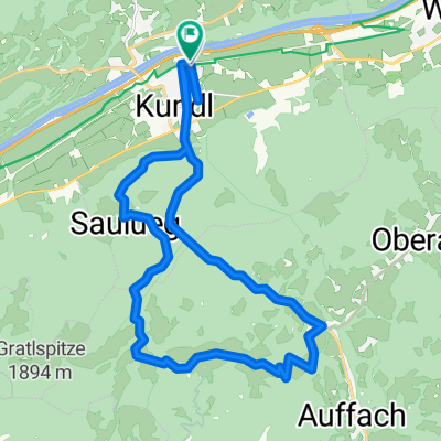
Breitenbach via Saulueg and Kundler Klamm back to Breitenbach
- -:--
- Duration
- 26.2 km
- Distance
- 695 m
- Ascent
- 692 m
- Descent
- ---
- Avg. speed
- ---
- Max. altitude
Route quality
Waytypes & surfaces along the route
Waytypes
Track
8.1 km
(31 %)
Road
5.5 km
(21 %)
Surfaces
Paved
5 km
(19 %)
Unpaved
6 km
(23 %)
Asphalt
5 km
(19 %)
Pebblestone
2.9 km
(11 %)
Continue with Bikemap
Use, edit, or download this cycling route
You would like to ride Breitenbach Saulueg Kundler Klamm or customize it for your own trip? Here is what you can do with this Bikemap route:
Free features
- Save this route as favorite or in collections
- Copy & plan your own version of this route
- Sync your route with Garmin or Wahoo
Premium features
Free trial for 3 days, or one-time payment. More about Bikemap Premium.
- Navigate this route on iOS & Android
- Export a GPX / KML file of this route
- Create your custom printout (try it for free)
- Download this route for offline navigation
Discover more Premium features.
Get Bikemap PremiumFrom our community
Other popular routes starting in Breitenbach am Inn
 Breitenbach Saulueg Kundler Klamm
- Distance
- 26.2 km
- Ascent
- 695 m
- Descent
- 692 m
- Location
- Breitenbach am Inn, Tyrol, Austria
 Hexenwasser
- Distance
- 24.3 km
- Ascent
- 751 m
- Descent
- 125 m
- Location
- Breitenbach am Inn, Tyrol, Austria
 Hexenwasser Brixen
- Distance
- 54.3 km
- Ascent
- 1,060 m
- Descent
- 1,061 m
- Location
- Breitenbach am Inn, Tyrol, Austria
 Kundl - Gramai - Pertisau - Schönau
- Distance
- 103.3 km
- Ascent
- 1,236 m
- Descent
- 1,239 m
- Location
- Breitenbach am Inn, Tyrol, Austria
 Rofan-Reibn: Durch die Gang zur Gramai
- Distance
- 110.9 km
- Ascent
- 1,365 m
- Descent
- 1,365 m
- Location
- Breitenbach am Inn, Tyrol, Austria
 Kundl-Saulueg-Thierbach-Kundl
- Distance
- 25.9 km
- Ascent
- 839 m
- Descent
- 839 m
- Location
- Breitenbach am Inn, Tyrol, Austria
 Kundl-Kaiserhaus-Buchacker-Kundl
- Distance
- 48.5 km
- Ascent
- 890 m
- Descent
- 889 m
- Location
- Breitenbach am Inn, Tyrol, Austria
 Angerberg-Runde
- Distance
- 27.2 km
- Ascent
- 511 m
- Descent
- 510 m
- Location
- Breitenbach am Inn, Tyrol, Austria
Open it in the app