

20140713_120343.gpx
A cycling route starting in Klimmen, Limburg, The Netherlands.
Overview
About this route
TEASI track
- -:--
- Duration
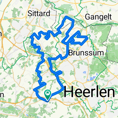
- 21.8 km
- Distance
- 211 m
- Ascent
- 211 m
- Descent
- ---
- Avg. speed
- ---
- Max. altitude
Continue with Bikemap
Use, edit, or download this cycling route
You would like to ride 20140713_120343.gpx or customize it for your own trip? Here is what you can do with this Bikemap route:
Free features
- Save this route as favorite or in collections
- Copy & plan your own version of this route
- Sync your route with Garmin or Wahoo
Premium features
Free trial for 3 days, or one-time payment. More about Bikemap Premium.
- Navigate this route on iOS & Android
- Export a GPX / KML file of this route
- Create your custom printout (try it for free)
- Download this route for offline navigation
Discover more Premium features.
Get Bikemap PremiumFrom our community
Other popular routes starting in Klimmen
 WimsMooiste, LO
- Distance
- 96.7 km
- Ascent
- 781 m
- Descent
- 781 m
- Location
- Klimmen, Limburg, The Netherlands
 Pletskeskooktoer!
- Distance
- 63.8 km
- Ascent
- 364 m
- Descent
- 365 m
- Location
- Klimmen, Limburg, The Netherlands
 Route 40, Dalhem
- Distance
- 75 km
- Ascent
- 387 m
- Descent
- 386 m
- Location
- Klimmen, Limburg, The Netherlands
 Hulsberg 1
- Distance
- 50.4 km
- Ascent
- 248 m
- Descent
- 248 m
- Location
- Klimmen, Limburg, The Netherlands
 Hell2024_Signaleurs
- Distance
- 150.8 km
- Ascent
- 1,752 m
- Descent
- 1,752 m
- Location
- Klimmen, Limburg, The Netherlands
 P10 Bingelrade RO
- Distance
- 61.2 km
- Ascent
- 469 m
- Descent
- 471 m
- Location
- Klimmen, Limburg, The Netherlands
 Rondje Hulsberg-Kotum(B)-Hulsberg.
- Distance
- 47.3 km
- Ascent
- 123 m
- Descent
- 126 m
- Location
- Klimmen, Limburg, The Netherlands
 Hell2023_Signaleurs-Enexis&WML
- Distance
- 149.7 km
- Ascent
- 1,696 m
- Descent
- 1,695 m
- Location
- Klimmen, Limburg, The Netherlands
Open it in the app