031 - 2014
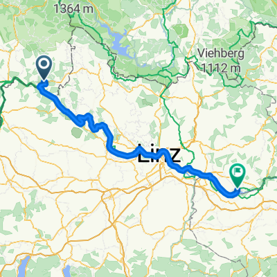
A cycling route starting in Untergriesbach, Bavaria, Germany.
Overview
About this route
22 lipiec - wyprawa rowerowa Italia & Alpy 2014
Untergriesbach - Dolní TÅ™ebonín 78 km- -:--
- Duration
- 77.2 km
- Distance
- 937 m
- Ascent
- 1,007 m
- Descent
- ---
- Avg. speed
- ---
- Avg. speed
Route quality
Waytypes & surfaces along the route
Waytypes
Busy road
58.3 km
(75 %)
Road
6.5 km
(8 %)
Surfaces
Paved
44.5 km
(58 %)
Unpaved
4.6 km
(6 %)
Asphalt
44.3 km
(57 %)
Gravel
4.5 km
(6 %)
Continue with Bikemap
Use, edit, or download this cycling route
You would like to ride 031 - 2014 or customize it for your own trip? Here is what you can do with this Bikemap route:
Free features
- Save this route as favorite or in collections
- Copy & plan your own version of this route
- Sync your route with Garmin or Wahoo
Premium features
Free trial for 3 days, or one-time payment. More about Bikemap Premium.
- Navigate this route on iOS & Android
- Export a GPX / KML file of this route
- Create your custom printout (try it for free)
- Download this route for offline navigation
Discover more Premium features.
Get Bikemap PremiumFrom our community
Other popular routes starting in Untergriesbach
- 031 - 2014
- Distance
- 77.2 km
- Ascent
- 937 m
- Descent
- 1,007 m
- Location
- Untergriesbach, Bavaria, Germany
- Ameisbergtour
- Distance
- 105.6 km
- Ascent
- 1,661 m
- Descent
- 1,782 m
- Location
- Untergriesbach, Bavaria, Germany
- Postweg 18, Untergriesbach nach PA47 21, Wegscheid
- Distance
- 48.1 km
- Ascent
- 879 m
- Descent
- 805 m
- Location
- Untergriesbach, Bavaria, Germany
- Wegscheid-Sonnen-Hauzenberg
- Distance
- 48.1 km
- Ascent
- 695 m
- Descent
- 734 m
- Location
- Untergriesbach, Bavaria, Germany
- Route nach Jochensteiner Straße 5, Obernzell
- Distance
- 18.9 km
- Ascent
- 423 m
- Descent
- 634 m
- Location
- Untergriesbach, Bavaria, Germany
- Hauzenberger Straße 5, Untergriesbach nach B388, Obernzell
- Distance
- 7.3 km
- Ascent
- 239 m
- Descent
- 331 m
- Location
- Untergriesbach, Bavaria, Germany
- Untergriesbach - Panorama Radweg
- Distance
- 39.3 km
- Ascent
- 672 m
- Descent
- 672 m
- Location
- Untergriesbach, Bavaria, Germany
- Gottsdorfer Straße 3, Untergriesbach nach Postweg 14, Untergriesbach
- Distance
- 33.2 km
- Ascent
- 693 m
- Descent
- 690 m
- Location
- Untergriesbach, Bavaria, Germany
Open it in the app