

Auersberg-Tour 01
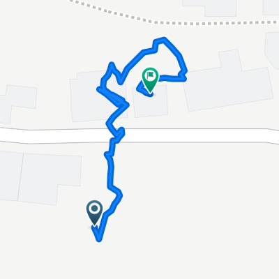
A cycling route starting in Wildenfels, Saxony, Germany.
Overview
About this route
Etwas Bergtraining gefällig?
Erst der Anstieg von Weißbach nach Langenbach, dann der Langen(weiß)bacher Berg, anschließend stetig aufwärts nach Blauenthal und nun im wahrsten Sinne des Wortes der Höhepunkt: der harte Aufstieg zum Auersberg.
Die Rückfahrt über Eibenstock ist dann schon fast gemütlich.
Viel Spaß !
- -:--
- Duration
- 65.8 km
- Distance
- 1,274 m
- Ascent
- 1,090 m
- Descent
- ---
- Avg. speed
- 1,000 m
- Max. altitude
Route quality
Waytypes & surfaces along the route
Waytypes
Track
24.5 km
(37 %)
Quiet road
18.4 km
(28 %)
Surfaces
Paved
29.8 km
(45 %)
Unpaved
24.2 km
(37 %)
Asphalt
28.4 km
(43 %)
Gravel
12.3 km
(19 %)
Route highlights
Points of interest along the route
Point of interest after 2.7 km
Zum Warmwerden: der Anstieg von Weißbach in Richtung Langenbach.
Point of interest after 7.2 km
Der Langen(weiß)bacher Berg. Wer hier noch keinen erhöhten Puls hat...
Continue with Bikemap
Use, edit, or download this cycling route
You would like to ride Auersberg-Tour 01 or customize it for your own trip? Here is what you can do with this Bikemap route:
Free features
- Save this route as favorite or in collections
- Copy & plan your own version of this route
- Sync your route with Garmin or Wahoo
Premium features
Free trial for 3 days, or one-time payment. More about Bikemap Premium.
- Navigate this route on iOS & Android
- Export a GPX / KML file of this route
- Create your custom printout (try it for free)
- Download this route for offline navigation
Discover more Premium features.
Get Bikemap PremiumFrom our community
Other popular routes starting in Wildenfels
 Lindenallee 47, Wildenfels nach Lindenallee 43, Wildenfels
- Distance
- 122.3 km
- Ascent
- 454 m
- Descent
- 445 m
- Location
- Wildenfels, Saxony, Germany
 Katzenstein-Tour 01
- Distance
- 55.4 km
- Ascent
- 877 m
- Descent
- 856 m
- Location
- Wildenfels, Saxony, Germany
 Rowi-Dresden Elbufer/Königsufer 2.Etape
- Distance
- 116.3 km
- Ascent
- 698 m
- Descent
- 922 m
- Location
- Wildenfels, Saxony, Germany
 Lindenallee 30, Wildenfels nach Lindenallee 45, Wildenfels
- Distance
- 12.6 km
- Ascent
- 271 m
- Descent
- 313 m
- Location
- Wildenfels, Saxony, Germany
 Lindenallee nach Lindenallee
- Distance
- 0.5 km
- Ascent
- 43 m
- Descent
- 47 m
- Location
- Wildenfels, Saxony, Germany
 Schulberg 4, Wildenfels nach Schulberg 4, Wildenfels
- Distance
- 22.1 km
- Ascent
- 380 m
- Descent
- 381 m
- Location
- Wildenfels, Saxony, Germany
 Bahnhof Wiesenburg/Sa. - Ziegelteich (MTB)
- Distance
- 18.9 km
- Ascent
- 308 m
- Descent
- 308 m
- Location
- Wildenfels, Saxony, Germany
 Auersberg-Tour 01
- Distance
- 65.8 km
- Ascent
- 1,274 m
- Descent
- 1,090 m
- Location
- Wildenfels, Saxony, Germany
Open it in the app