

Laruns - Superbagnères
- 229.5 km
- 5,682 m
- 4,398 m
- Laruns, Nouvelle-Aquitaine, France
A cycling route starting in Laruns, Nouvelle-Aquitaine, France.
Overview
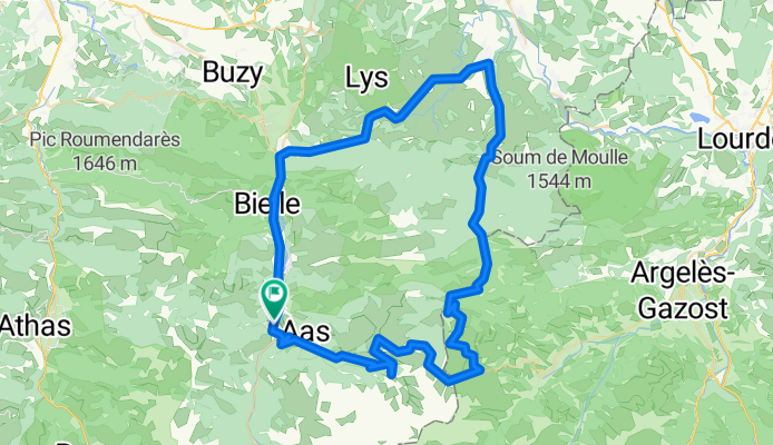
Circular route starting and finishing in Laruns. Climbing Aubisque and reaching the summit of Soulour via the easier side (2.5 km). Descending Soulour via Ferreries down to Asson. From Asson to Laruns is a section with rollers.
created this 11 years ago
Route quality
Quiet road
1.7 km
(2 %)
Track
1.7 km
(2 %)
Paved
60.3 km
(69 %)
Unpaved
1.7 km
(2 %)
Asphalt
60.3 km
(69 %)
Gravel
1.7 km
(2 %)
Undefined
25.4 km
(29 %)
Continue with Bikemap
You would like to ride Laruns-Aubisque-Laruns or customize it for your own trip? Here is what you can do with this Bikemap route:
Free trial for 3 days, or one-time payment. More about Bikemap Premium.
Discover more Premium features.
Get Bikemap PremiumFrom our community
Open it in the app