

Valcolla
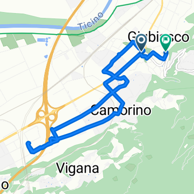
A cycling route starting in Giubiasco, Canton Ticino, Switzerland.
Overview
About this route
Giubiasco - St. Antonino - Mte Ceneri - Rivera - Mezzovico - Taverne - Origlio - Cureglia - Comano - Canobbio - Pregassona - Cadro - Sonvico - Piandera - Bogno - Scareglia - Bidogno - Lopagno - Tesserete - Vaglio - Ponte Capriasca - Taverne - Mezzovico - Rivera - Mte Ceneri - St. Antonino - Camorino - Giubiasco.
Elevation change 1'735 m.
- -:--
- Duration
- 86 km
- Distance
- 1,488 m
- Ascent
- 1,488 m
- Descent
- ---
- Avg. speed
- ---
- Max. altitude
Route quality
Waytypes & surfaces along the route
Waytypes
Road
37.9 km
(44 %)
Quiet road
11.2 km
(13 %)
Surfaces
Paved
65.4 km
(76 %)
Asphalt
65.4 km
(76 %)
Undefined
20.7 km
(24 %)
Continue with Bikemap
Use, edit, or download this cycling route
You would like to ride Valcolla or customize it for your own trip? Here is what you can do with this Bikemap route:
Free features
- Save this route as favorite or in collections
- Copy & plan your own version of this route
- Split it into stages to create a multi-day tour
- Sync your route with Garmin or Wahoo
Premium features
Free trial for 3 days, or one-time payment. More about Bikemap Premium.
- Navigate this route on iOS & Android
- Export a GPX / KML file of this route
- Create your custom printout (try it for free)
- Download this route for offline navigation
Discover more Premium features.
Get Bikemap PremiumFrom our community
Other popular routes starting in Giubiasco
 Da Viale Camillo Olgiati 11, Giubiasco a Viale Camillo Olgiati 11, Giubiasco
- Distance
- 16.8 km
- Ascent
- 208 m
- Descent
- 203 m
- Location
- Giubiasco, Canton Ticino, Switzerland
 Val Verzasca
- Distance
- 43.5 km
- Ascent
- 1,631 m
- Descent
- 848 m
- Location
- Giubiasco, Canton Ticino, Switzerland
 tessin
- Distance
- 92 km
- Ascent
- 900 m
- Descent
- 900 m
- Location
- Giubiasco, Canton Ticino, Switzerland
 Via Industrie, Giubiasco a Quartiere Rusca e Saleggi, Locarno
- Distance
- 21.7 km
- Ascent
- 77 m
- Descent
- 107 m
- Location
- Giubiasco, Canton Ticino, Switzerland
 2 giro
- Distance
- 10.5 km
- Ascent
- 59 m
- Descent
- 65 m
- Location
- Giubiasco, Canton Ticino, Switzerland
 1 giro
- Distance
- 7.3 km
- Ascent
- 32 m
- Descent
- 40 m
- Location
- Giubiasco, Canton Ticino, Switzerland
 Da Via Eduardo Berta 1, Giubiasco a Viale Stefano Franscini 35, Bellinzona
- Distance
- 39.5 km
- Ascent
- 375 m
- Descent
- 398 m
- Location
- Giubiasco, Canton Ticino, Switzerland
 Zürich Valpiana (Toskana) 2. Etappe Bellinzona-Piacenza
- Distance
- 197.3 km
- Ascent
- 532 m
- Descent
- 702 m
- Location
- Giubiasco, Canton Ticino, Switzerland
Open it in the app