

Bad Bentheim Tagestour 01
A cycling route starting in Bad Bentheim, Lower Saxony, Germany.
Overview
About this route
Bad Bentheim Day Tour 01
(cloned from route 1861592)
- -:--
- Duration
- 92.7 km
- Distance
- 138 m
- Ascent
- 171 m
- Descent
- ---
- Avg. speed
- ---
- Max. altitude
Route quality
Waytypes & surfaces along the route
Waytypes
Quiet road
35.2 km
(38 %)
Path
17.6 km
(19 %)
Surfaces
Paved
61.2 km
(66 %)
Unpaved
9.3 km
(10 %)
Asphalt
53.8 km
(58 %)
Paved (undefined)
7.4 km
(8 %)
Route highlights
Points of interest along the route

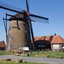
Photo after 17.1 km
Haddorfer See

Photo after 24.4 km
Kirche St. Cyriakus

Photo after 29.1 km
Schutzhüttte

Photo after 32 km

Photo after 46.4 km
Quendorfer See

Photo after 48.4 km
Schüttorf - Altes Rathaus

Photo after 53.5 km
Bentheimer Mineral Therme

Photo after 54.8 km
Bad Bentheim, Bahnhof

Photo after 55.6 km
Bad Bentheim
Continue with Bikemap
Use, edit, or download this cycling route
You would like to ride Bad Bentheim Tagestour 01 or customize it for your own trip? Here is what you can do with this Bikemap route:
Free features
- Save this route as favorite or in collections
- Copy & plan your own version of this route
- Split it into stages to create a multi-day tour
- Sync your route with Garmin or Wahoo
Premium features
Free trial for 3 days, or one-time payment. More about Bikemap Premium.
- Navigate this route on iOS & Android
- Export a GPX / KML file of this route
- Create your custom printout (try it for free)
- Download this route for offline navigation
Discover more Premium features.
Get Bikemap PremiumFrom our community
Other popular routes starting in Bad Bentheim
 Graftschafter Fietstour (Tag 3a)
- Distance
- 60.4 km
- Ascent
- 119 m
- Descent
- 101 m
- Location
- Bad Bentheim, Lower Saxony, Germany
 Grafschafter Fietsentour (GFT) Nr. 23
- Distance
- 35.6 km
- Ascent
- 131 m
- Descent
- 131 m
- Location
- Bad Bentheim, Lower Saxony, Germany
 Gildehaus-Losser-Magretsstübchen-Gildehaus
- Distance
- 37.8 km
- Ascent
- 75 m
- Descent
- 75 m
- Location
- Bad Bentheim, Lower Saxony, Germany
 Bad Bentheim
- Distance
- 30.4 km
- Ascent
- 91 m
- Descent
- 88 m
- Location
- Bad Bentheim, Lower Saxony, Germany
 Bad Bentheim
- Distance
- 28.3 km
- Ascent
- 68 m
- Descent
- 68 m
- Location
- Bad Bentheim, Lower Saxony, Germany
 Kleine Dinkelrunde
- Distance
- 17.7 km
- Ascent
- 48 m
- Descent
- 49 m
- Location
- Bad Bentheim, Lower Saxony, Germany
 NS712: Bad Bentheim - Schuettorf - Gildehaus - Gildehauser Venn
- Distance
- 45.5 km
- Ascent
- 163 m
- Descent
- 165 m
- Location
- Bad Bentheim, Lower Saxony, Germany
 Gildehaus-Dinkel-Route CLONED FROM ROUTE 212864
- Distance
- 37.9 km
- Ascent
- 130 m
- Descent
- 126 m
- Location
- Bad Bentheim, Lower Saxony, Germany
Open it in the app