

randovélo : grenoble - mimizan plage
A cycling route starting in Seyssins, Auvergne-Rhône-Alpes, France.
Overview
About this route
Three friends decided one fine day to set off from the mountains to reach the ocean...
- -:--
- Duration
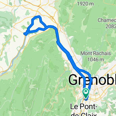
- 819.4 km
- Distance
- 11,695 m
- Ascent
- 12,790 m
- Descent
- ---
- Avg. speed
- 1,586 m
- Max. altitude
Route quality
Waytypes & surfaces along the route
Waytypes
Quiet road
81.9 km
(10 %)
Road
57.4 km
(7 %)
Surfaces
Paved
368.7 km
(45 %)
Unpaved
8.2 km
(1 %)
Asphalt
368.7 km
(45 %)
Ground
8.2 km
(1 %)
Undefined
442.5 km
(54 %)
Continue with Bikemap
Use, edit, or download this cycling route
You would like to ride randovélo : grenoble - mimizan plage or customize it for your own trip? Here is what you can do with this Bikemap route:
Free features
- Save this route as favorite or in collections
- Copy & plan your own version of this route
- Split it into stages to create a multi-day tour
- Sync your route with Garmin or Wahoo
Premium features
Free trial for 3 days, or one-time payment. More about Bikemap Premium.
- Navigate this route on iOS & Android
- Export a GPX / KML file of this route
- Create your custom printout (try it for free)
- Download this route for offline navigation
Discover more Premium features.
Get Bikemap PremiumFrom our community
Other popular routes starting in Seyssins
 randovélo : grenoble - mimizan plage
- Distance
- 819.4 km
- Ascent
- 11,695 m
- Descent
- 12,790 m
- Location
- Seyssins, Auvergne-Rhône-Alpes, France
 De 14 Rue Henri Barbusse, Échirolles à 12 Allée François Villon, Échirolles
- Distance
- 62.5 km
- Ascent
- 866 m
- Descent
- 871 m
- Location
- Seyssins, Auvergne-Rhône-Alpes, France
 2009 J1 Seyssins - Villars de Lans
- Distance
- 34 km
- Ascent
- 1,079 m
- Descent
- 282 m
- Location
- Seyssins, Auvergne-Rhône-Alpes, France
 Itineraire Saint Nizier -Roynac en vélo de route
- Distance
- 138.6 km
- Ascent
- 726 m
- Descent
- 1,574 m
- Location
- Seyssins, Auvergne-Rhône-Alpes, France
 2019 - 6a - ok
- Distance
- 79.3 km
- Ascent
- 1,806 m
- Descent
- 1,310 m
- Location
- Seyssins, Auvergne-Rhône-Alpes, France
 2019 - 6a
- Distance
- 79.8 km
- Ascent
- 1,773 m
- Descent
- 1,280 m
- Location
- Seyssins, Auvergne-Rhône-Alpes, France
 MID - Champagnier - Vif - Varces - MID
- Distance
- 35.7 km
- Ascent
- 303 m
- Descent
- 303 m
- Location
- Seyssins, Auvergne-Rhône-Alpes, France
 ETAPE 1 : SAINT NIZIER - VASSIEUX EN VERCORS
- Distance
- 55.6 km
- Ascent
- 736 m
- Descent
- 842 m
- Location
- Seyssins, Auvergne-Rhône-Alpes, France
Open it in the app