

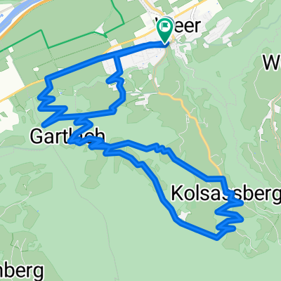
Weer-Kühtai-Ötz-Sölden
A cycling route starting in Kolsassberg, Tyrol, Austria.
Overview
About this route
Weer-Kühtai-Ötz-Sölden
- -:--
- Duration
- 112.1 km
- Distance
- 2,327 m
- Ascent
- 1,536 m
- Descent
- ---
- Avg. speed
- ---
- Avg. speed
Route quality
Waytypes & surfaces along the route
Waytypes
Busy road
86 km
(77 %)
Quiet road
12.4 km
(11 %)
Surfaces
Paved
98.5 km
(88 %)
Unpaved
5.2 km
(5 %)
Asphalt
98.3 km
(88 %)
Unpaved (undefined)
2.9 km
(3 %)
Continue with Bikemap
Use, edit, or download this cycling route
You would like to ride Weer-Kühtai-Ötz-Sölden or customize it for your own trip? Here is what you can do with this Bikemap route:
Free features
- Save this route as favorite or in collections
- Copy & plan your own version of this route
- Sync your route with Garmin or Wahoo
Premium features
Free trial for 3 days, or one-time payment. More about Bikemap Premium.
- Navigate this route on iOS & Android
- Export a GPX / KML file of this route
- Create your custom printout (try it for free)
- Download this route for offline navigation
Discover more Premium features.
Get Bikemap PremiumFrom our community
Other popular routes starting in Kolsassberg
 Tour 1 Kolsassberg
- Distance
- 16.6 km
- Ascent
- 755 m
- Descent
- 755 m
- Location
- Kolsassberg, Tyrol, Austria
 Tag 3 Etappe 2 Von Telfs- Pfaffenhofen Nach Wörgl
- Distance
- 47.1 km
- Ascent
- 22 m
- Descent
- 53 m
- Location
- Kolsassberg, Tyrol, Austria
 Volderbergrunde
- Distance
- 24.8 km
- Ascent
- 1,123 m
- Descent
- 629 m
- Location
- Kolsassberg, Tyrol, Austria
 Bregenz-Brno day4of9
- Distance
- 125.3 km
- Ascent
- 811 m
- Descent
- 653 m
- Location
- Kolsassberg, Tyrol, Austria
 Weerberg
- Distance
- 6.9 km
- Ascent
- 436 m
- Descent
- 109 m
- Location
- Kolsassberg, Tyrol, Austria
 Weer-Kühtai-Ötz-Sölden
- Distance
- 112.1 km
- Ascent
- 2,327 m
- Descent
- 1,536 m
- Location
- Kolsassberg, Tyrol, Austria
 Zweite Etappe - Geiseljoch
- Distance
- 23.3 km
- Ascent
- 1,584 m
- Descent
- 625 m
- Location
- Kolsassberg, Tyrol, Austria
 tag 4.4
- Distance
- 91.7 km
- Ascent
- 695 m
- Descent
- 592 m
- Location
- Kolsassberg, Tyrol, Austria
Open it in the app