

Alsenztal
A cycling route starting in Bad Münster am Stein-Ebernburg, Rhineland-Palatinate, Germany.
Overview
About this route
<p>
Close to nature in the heart of the Palatinate. Short stretches of poor quality. Otherwise a day tour full of experiences. For football fans, Alsenborn (Fritz Walter) is of course an absolute highlight.</p>
Translated, show original (German)- -:--
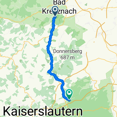
- Duration
- 49.8 km
- Distance
- 336 m
- Ascent
- 158 m
- Descent
- ---
- Avg. speed
- ---
- Max. altitude

Route quality
Waytypes & surfaces along the route
Waytypes
Track
16.9 km
(34 %)
Quiet road
10 km
(20 %)
Surfaces
Paved
37.4 km
(75 %)
Unpaved
3.5 km
(7 %)
Asphalt
33.4 km
(67 %)
Paved (undefined)
4 km
(8 %)
Continue with Bikemap
Use, edit, or download this cycling route
You would like to ride Alsenztal or customize it for your own trip? Here is what you can do with this Bikemap route:
Free features
- Save this route as favorite or in collections
- Copy & plan your own version of this route
- Sync your route with Garmin or Wahoo
Premium features
Free trial for 3 days, or one-time payment. More about Bikemap Premium.
- Navigate this route on iOS & Android
- Export a GPX / KML file of this route
- Create your custom printout (try it for free)
- Download this route for offline navigation
Discover more Premium features.
Get Bikemap PremiumFrom our community
Other popular routes starting in Bad Münster am Stein-Ebernburg
 An der Nahe
- Distance
- 47 km
- Ascent
- 376 m
- Descent
- 264 m
- Location
- Bad Münster am Stein-Ebernburg, Rhineland-Palatinate, Germany
 Alsenztal
- Distance
- 49.8 km
- Ascent
- 336 m
- Descent
- 158 m
- Location
- Bad Münster am Stein-Ebernburg, Rhineland-Palatinate, Germany
 Tagesausflug im Sommer 2017
- Distance
- 58.1 km
- Ascent
- 417 m
- Descent
- 420 m
- Location
- Bad Münster am Stein-Ebernburg, Rhineland-Palatinate, Germany
 2025 Tag 5 Bad Münster-Allenbach
- Distance
- 70.4 km
- Ascent
- 1,201 m
- Descent
- 831 m
- Location
- Bad Münster am Stein-Ebernburg, Rhineland-Palatinate, Germany
 Lange Radrunde durch Bad Kreuznach
- Distance
- 53 km
- Ascent
- 435 m
- Descent
- 435 m
- Location
- Bad Münster am Stein-Ebernburg, Rhineland-Palatinate, Germany
 Nahe - Bingen - Mainz
- Distance
- 58.5 km
- Ascent
- 60 m
- Descent
- 83 m
- Location
- Bad Münster am Stein-Ebernburg, Rhineland-Palatinate, Germany
 3 Hügel-Runde Bad Kreuznach
- Distance
- 33.2 km
- Ascent
- 592 m
- Descent
- 592 m
- Location
- Bad Münster am Stein-Ebernburg, Rhineland-Palatinate, Germany
 Heimatnah 4.Etappe Naheradweg 2.Teil
- Distance
- 64.4 km
- Ascent
- 340 m
- Descent
- 199 m
- Location
- Bad Münster am Stein-Ebernburg, Rhineland-Palatinate, Germany
Open it in the app