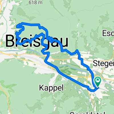
Kirchzarten-Jägerheim(Zastler)-Kirchzarten
- 32.2 km
- 915 m
- 913 m
- Kirchzarten, Baden-Wurttemberg, Germany
A cycling route starting in Kirchzarten, Baden-Wurttemberg, Germany.
Overview
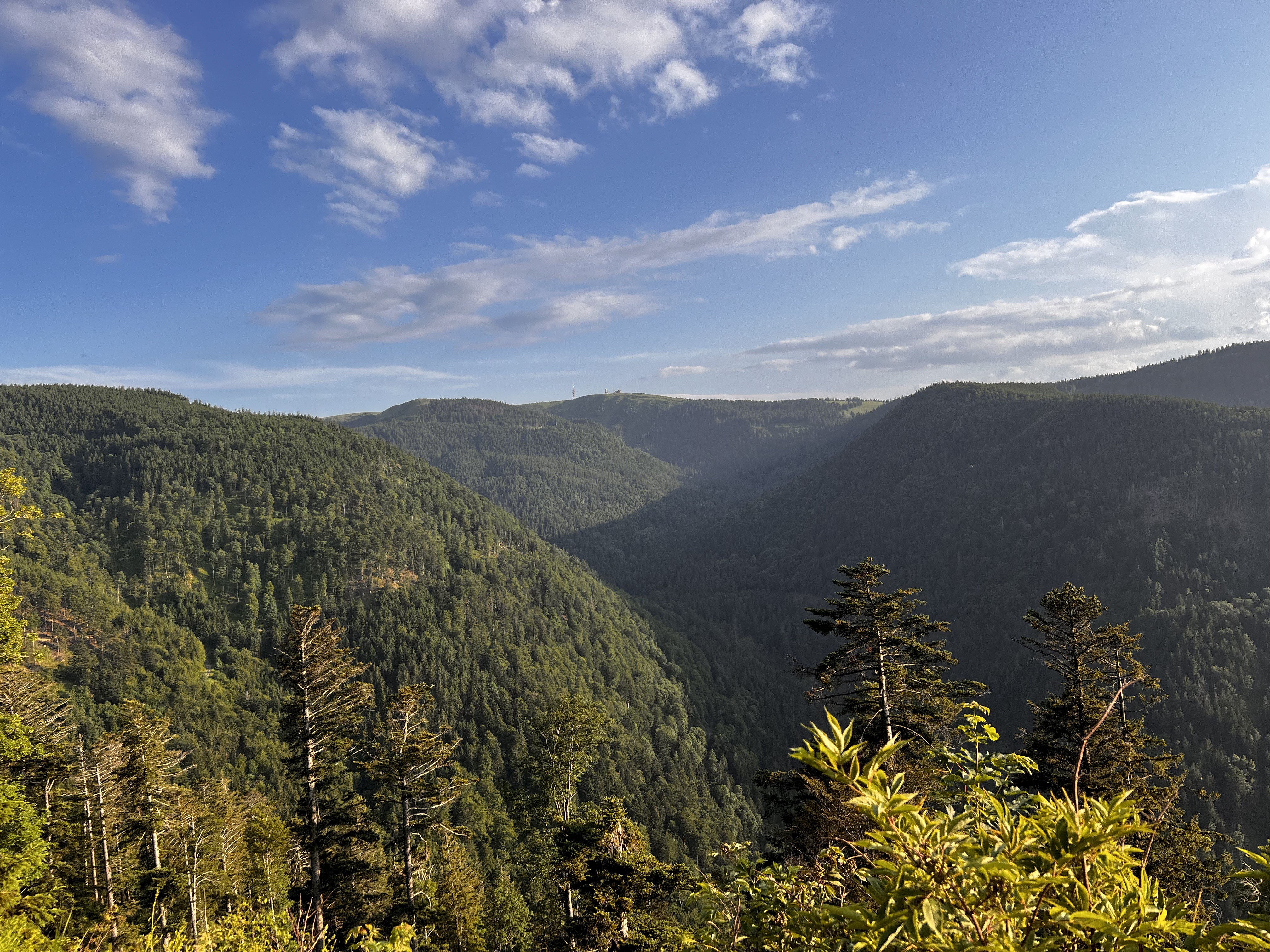
This tour begins in Kirchzarten. We leave the town heading west, cross the L126 at the campsite, and remain on Dietenbacher Street for a bit longer. Behind the Rössle country inn, near the young farmer's farm, we turn left. At Geroldstall Street, we also keep left, but then immediately turn right again. We head south towards Oberried. There, we turn left onto Klosterweg and follow the Vörlingsbach stream on the right. As soon as the path forks behind the campsite, we turn left. We stay on the main path and continue cycling south. Our next destination is the mountain inn Erlenbacher Hütte. From there, we go over Ahornkopf to the Zastler Hütte (1256 m). Here, we keep right and cycle over Immisberg (1373 m) to the St. Wilhelmer Hütte. Now it's only a few minutes to the summit of Feldberg (1493 m), although the last meters must be pushed. At the summit, we are rewarded with a magnificent panoramic view. After a thorough rest at the summit, we head to the upper station of the Seebuckbahn cable car and finally descend over Seebuck (1448 m) into the valley to Feldberger Hof. From there, we proceed above Lake Feldsee to Raimartihof, where a stop is also possible. Then we continue over the Rufenhütte and Hinterwaldkopf to the Rotecksattel. Now it’s all downhill. We rush past Höfener Hütte and Geiersberg before returning to the outskirts of Kirchzarten and reaching our starting altitude again.
created this 11 years ago
Route quality
Track
30.5 km
(62 %)
Path
6.9 km
(14 %)
Paved
15.2 km
(31 %)
Unpaved
32.9 km
(67 %)
Gravel
21.1 km
(43 %)
Asphalt
15.2 km
(31 %)
Continue with Bikemap
You would like to ride Von Kirchzarten auf den Feldberg or customize it for your own trip? Here is what you can do with this Bikemap route:
Free trial for 3 days, or one-time payment. More about Bikemap Premium.
Discover more Premium features.
Get Bikemap PremiumFrom our community
Open it in the app