

Aschenbrennemarter
A cycling route starting in Brennberg, Bavaria, Germany.
Overview
About this route
Forest road
- -:--
- Duration
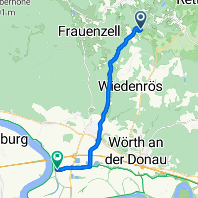
- 34.5 km
- Distance
- 614 m
- Ascent
- 614 m
- Descent
- ---
- Avg. speed
- ---
- Max. altitude
Continue with Bikemap
Use, edit, or download this cycling route
You would like to ride Aschenbrennemarter or customize it for your own trip? Here is what you can do with this Bikemap route:
Free features
- Save this route as favorite or in collections
- Copy & plan your own version of this route
- Sync your route with Garmin or Wahoo
Premium features
Free trial for 3 days, or one-time payment. More about Bikemap Premium.
- Navigate this route on iOS & Android
- Export a GPX / KML file of this route
- Create your custom printout (try it for free)
- Download this route for offline navigation
Discover more Premium features.
Get Bikemap PremiumFrom our community
Other popular routes starting in Brennberg
 Auf und Ab im Bayer. Wald
- Distance
- 18 km
- Ascent
- 310 m
- Descent
- 311 m
- Location
- Brennberg, Bavaria, Germany
 Aschenbrennemarter
- Distance
- 34.5 km
- Ascent
- 614 m
- Descent
- 614 m
- Location
- Brennberg, Bavaria, Germany
 hoch Edik
- Distance
- 34.6 km
- Ascent
- 783 m
- Descent
- 937 m
- Location
- Brennberg, Bavaria, Germany
 Höllmühle 1, Brennberg to Kiefenholz 12, Wörth an der Donau
- Distance
- 10.2 km
- Ascent
- 92 m
- Descent
- 207 m
- Location
- Brennberg, Bavaria, Germany
 Mariastiftstraße 3, Brennberg nach Mariastiftstraße 3, Brennberg
- Distance
- 10.8 km
- Ascent
- 345 m
- Descent
- 345 m
- Location
- Brennberg, Bavaria, Germany
 Große Brennbergrunde
- Distance
- 39.3 km
- Ascent
- 590 m
- Descent
- 590 m
- Location
- Brennberg, Bavaria, Germany
 Neuhaus Höllbach
- Distance
- 22.3 km
- Ascent
- 539 m
- Descent
- 539 m
- Location
- Brennberg, Bavaria, Germany
 Ebike Tour
- Distance
- 20.5 km
- Ascent
- 396 m
- Descent
- 451 m
- Location
- Brennberg, Bavaria, Germany
Open it in the app