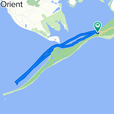
shelter island go around
A cycling route starting in Greenport, New York, United States.
Overview
About this route
shelter island tour
- -:--
- Duration
- 36.9 km
- Distance
- 180 m
- Ascent
- 180 m
- Descent
- ---
- Avg. speed
- ---
- Max. altitude
Route quality
Waytypes & surfaces along the route
Waytypes
Road
25.3 km
(69 %)
Busy road
8.6 km
(23 %)
Surfaces
Paved
0.7 km
(2 %)
Paved (undefined)
0.6 km
(2 %)
Concrete
0 km
(<1 %)
Undefined
36.3 km
(98 %)
Continue with Bikemap
Use, edit, or download this cycling route
You would like to ride shelter island go around or customize it for your own trip? Here is what you can do with this Bikemap route:
Free features
- Save this route as favorite or in collections
- Copy & plan your own version of this route
- Sync your route with Garmin or Wahoo
Premium features
Free trial for 3 days, or one-time payment. More about Bikemap Premium.
- Navigate this route on iOS & Android
- Export a GPX / KML file of this route
- Create your custom printout (try it for free)
- Download this route for offline navigation
Discover more Premium features.
Get Bikemap PremiumFrom our community
Other popular routes starting in Greenport
- Vineyards
- Distance
- 4.3 km
- Ascent
- 5 m
- Descent
- 20 m
- Location
- Greenport, New York, United States
- 15175–15507 Main Rd, East Marion to 7430 Main Rd, East Marion
- Distance
- 2.5 km
- Ascent
- 10 m
- Descent
- 3 m
- Location
- Greenport, New York, United States
- TEST ROUTE
- Distance
- 83 km
- Ascent
- 97 m
- Descent
- 98 m
- Location
- Greenport, New York, United States
- 1001–1037 Cedar Ln, East Marion to 58775 North Rd, Greenport
- Distance
- 5.5 km
- Ascent
- 13 m
- Descent
- 19 m
- Location
- Greenport, New York, United States
- 82 Gardiners Bay Dr, Shelter Island Heights to 42–68 Winthrop Rd, Shelter Island Heights
- Distance
- 3.4 km
- Ascent
- 0 m
- Descent
- 7 m
- Location
- Greenport, New York, United States
- 20275 Main Rd, Orient to 545 NY-25A, Saint James
- Distance
- 92.9 km
- Ascent
- 0 m
- Descent
- 3 m
- Location
- Greenport, New York, United States
- 1–33 Ivy Pl, Shelter Island Heights to 2–60 Ram Island Dr, Shelter Island Heights
- Distance
- 4.2 km
- Ascent
- 18 m
- Descent
- 38 m
- Location
- Greenport, New York, United States
- State Parkway, Orient to State Parkway, Orient
- Distance
- 7.3 km
- Ascent
- 11 m
- Descent
- 10 m
- Location
- Greenport, New York, United States
Open it in the app