

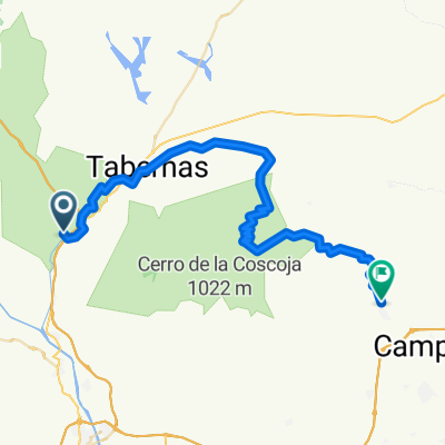
Gádor - Tabernas
A cycling route starting in Gádor, Andalusia, Spain.
Overview
About this route
Gádor - Tabernas on foot
- -:--
- Duration
- 17.3 km
- Distance
- 327 m
- Ascent
- 83 m
- Descent
- ---
- Avg. speed
- ---
- Max. altitude
Continue with Bikemap
Use, edit, or download this cycling route
You would like to ride Gádor - Tabernas or customize it for your own trip? Here is what you can do with this Bikemap route:
Free features
- Save this route as favorite or in collections
- Copy & plan your own version of this route
- Sync your route with Garmin or Wahoo
Premium features
Free trial for 3 days, or one-time payment. More about Bikemap Premium.
- Navigate this route on iOS & Android
- Export a GPX / KML file of this route
- Create your custom printout (try it for free)
- Download this route for offline navigation
Discover more Premium features.
Get Bikemap PremiumFrom our community
Other popular routes starting in Gádor
 Gádor-Alhama-vereas II
- Distance
- 32.6 km
- Ascent
- 911 m
- Descent
- 911 m
- Location
- Gádor, Andalusia, Spain
 Gador Gador por Ricaberal CLONED FROM ROUTE 343344
- Distance
- 57.9 km
- Ascent
- 731 m
- Descent
- 732 m
- Location
- Gádor, Andalusia, Spain
 Ruta cinematográfica Tabernas
- Distance
- 41.7 km
- Ascent
- 570 m
- Descent
- 570 m
- Location
- Gádor, Andalusia, Spain
 Gádor - Níjar
- Distance
- 52.6 km
- Ascent
- 1,114 m
- Descent
- 986 m
- Location
- Gádor, Andalusia, Spain
 Gádor - Tabernas
- Distance
- 17.3 km
- Ascent
- 327 m
- Descent
- 83 m
- Location
- Gádor, Andalusia, Spain
 Gádor-Alhama-veredas
- Distance
- 32.4 km
- Ascent
- 852 m
- Descent
- 852 m
- Location
- Gádor, Andalusia, Spain
 Gador - Ricaveral - Estacion Fuente Santa
- Distance
- 41.2 km
- Ascent
- 582 m
- Descent
- 580 m
- Location
- Gádor, Andalusia, Spain
 Gador - Estación Sta. Fe - Arbol del Ahorcado
- Distance
- 35.6 km
- Ascent
- 504 m
- Descent
- 504 m
- Location
- Gádor, Andalusia, Spain
Open it in the app