

p31 Col du Petit Saint-Bernard
A cycling route starting in Séez, Auvergne-Rhône-Alpes, France.
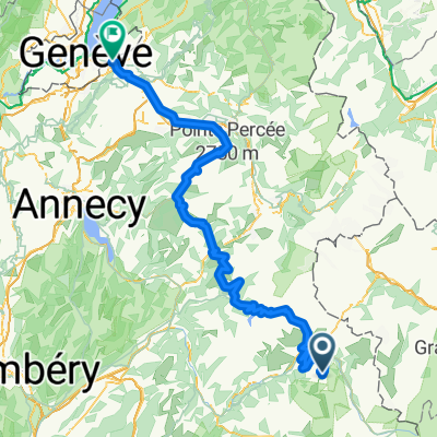
Overview
About this route
Colle del Piccolo San Bernardo / Little St Bernard Pass 2188 m above sea level.
I rode on 13.07.2014 from Sainte-Foy-Tarentaise to Chenoz.
- -:--
- Duration
- 56.4 km
- Distance
- 1,466 m
- Ascent
- 1,524 m
- Descent
- ---
- Avg. speed
- ---
- Max. altitude

Route quality
Waytypes & surfaces along the route
Waytypes
Road
9 km
(16 %)
Quiet road
0.6 km
(1 %)
Surfaces
Paved
53.1 km
(94 %)
Asphalt
52.5 km
(93 %)
Concrete
0.6 km
(1 %)
Undefined
3.4 km
(6 %)
Route highlights
Points of interest along the route

Point of interest after 33.2 km
Colle del Piccolo San Bernardo 2188 m n.p.m. 13.07.2014
Point of interest after 33.3 km
Na Colle del Piccolo San Bernardo
Continue with Bikemap
Use, edit, or download this cycling route
You would like to ride p31 Col du Petit Saint-Bernard or customize it for your own trip? Here is what you can do with this Bikemap route:
Free features
- Save this route as favorite or in collections
- Copy & plan your own version of this route
- Sync your route with Garmin or Wahoo
Premium features
Free trial for 3 days, or one-time payment. More about Bikemap Premium.
- Navigate this route on iOS & Android
- Export a GPX / KML file of this route
- Create your custom printout (try it for free)
- Download this route for offline navigation
Discover more Premium features.
Get Bikemap PremiumFrom our community
Other popular routes starting in Séez
 Briançon - Arc 2000
- Distance
- 203 km
- Ascent
- 3,914 m
- Descent
- 4,894 m
- Location
- Séez, Auvergne-Rhône-Alpes, France
 Annemasse - Arc 2000
- Distance
- 179.2 km
- Ascent
- 3,155 m
- Descent
- 4,887 m
- Location
- Séez, Auvergne-Rhône-Alpes, France
 Transalpine (11) Bourg St. Maurice - Vijaron
- Distance
- 64.9 km
- Ascent
- 2,025 m
- Descent
- 1,097 m
- Location
- Séez, Auvergne-Rhône-Alpes, France
 p31 Col du Petit Saint-Bernard
- Distance
- 56.4 km
- Ascent
- 1,466 m
- Descent
- 1,524 m
- Location
- Séez, Auvergne-Rhône-Alpes, France
 Col de l'Iseran
- Distance
- 76.5 km
- Ascent
- 1,977 m
- Descent
- 1,473 m
- Location
- Séez, Auvergne-Rhône-Alpes, France
 Seez - Lanslevillard
- Distance
- 76.7 km
- Ascent
- 1,968 m
- Descent
- 1,399 m
- Location
- Séez, Auvergne-Rhône-Alpes, France
 Tour de France 2016 dzień 9
- Distance
- 92.4 km
- Ascent
- 1,743 m
- Descent
- 1,841 m
- Location
- Séez, Auvergne-Rhône-Alpes, France
 Iseran
- Distance
- 42.6 km
- Ascent
- 2,037 m
- Descent
- 136 m
- Location
- Séez, Auvergne-Rhône-Alpes, France
Open it in the app