

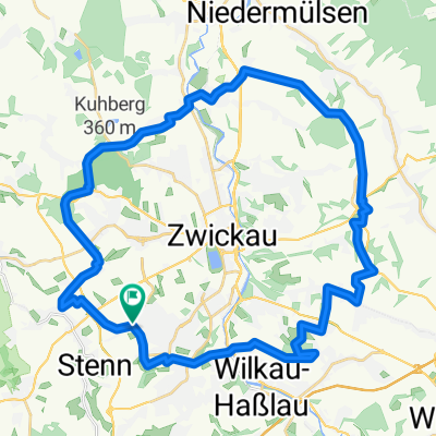
Rundfahrt Zwickau - Zschorlau
A cycling route starting in Lichtentanne, Saxony, Germany.
Overview
About this route
Schöne Rundtour mit dem Mountainbike über größtenteils Autofreie Wege durch den Forst.
- -:--
- Duration
- 61.1 km
- Distance
- 803 m
- Ascent
- 803 m
- Descent
- ---
- Avg. speed
- ---
- Max. altitude
Route quality
Waytypes & surfaces along the route
Waytypes
Track
23.2 km
(38 %)
Quiet road
20.6 km
(34 %)
Surfaces
Paved
30.6 km
(50 %)
Unpaved
22.2 km
(36 %)
Asphalt
26.6 km
(43 %)
Loose gravel
6.8 km
(11 %)
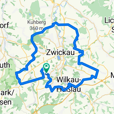
Route highlights
Points of interest along the route

Point of interest after 14 km
blick ins zwickauer land
Point of interest after 17.7 km
Blick auf Weißbach

Point of interest after 23.7 km
filzteich

Point of interest after 25.6 km
Blick nach Zschorlau

Point of interest after 29.6 km
bei Albernau, Blick aufs Erzgebirge

Point of interest after 36.6 km
Blick auf Schneeberg

Point of interest after 38.8 km
Kirche St. Wolfgang in Schneeberg

Point of interest after 39.1 km
Markt in Schneeberg

Point of interest after 41.6 km
Der keilberg

Point of interest after 41.7 km
Blick nach Schneeberg und auf den Fichtelberg

Point of interest after 55.8 km
Blick auf die Rad/fussgängerbrücke in Wilkau Haßlau
Continue with Bikemap
Use, edit, or download this cycling route
You would like to ride Rundfahrt Zwickau - Zschorlau or customize it for your own trip? Here is what you can do with this Bikemap route:
Free features
- Save this route as favorite or in collections
- Copy & plan your own version of this route
- Sync your route with Garmin or Wahoo
Premium features
Free trial for 3 days, or one-time payment. More about Bikemap Premium.
- Navigate this route on iOS & Android
- Export a GPX / KML file of this route
- Create your custom printout (try it for free)
- Download this route for offline navigation
Discover more Premium features.
Get Bikemap PremiumFrom our community
Other popular routes starting in Lichtentanne
 Männertag 2015
- Distance
- 286.4 km
- Ascent
- 202 m
- Descent
- 408 m
- Location
- Lichtentanne, Saxony, Germany
 Zwickau/Planitz - Mülsengrund und zurück
- Distance
- 40.1 km
- Ascent
- 258 m
- Descent
- 304 m
- Location
- Lichtentanne, Saxony, Germany
 Zwickau - Kirchberg
- Distance
- 33.9 km
- Ascent
- 280 m
- Descent
- 304 m
- Location
- Lichtentanne, Saxony, Germany
 Huegelig Kirchberg Niedercrinitz Rottmannsdorf
- Distance
- 35.7 km
- Ascent
- 542 m
- Descent
- 542 m
- Location
- Lichtentanne, Saxony, Germany
 Marienthal - Niederschindmaas
- Distance
- 18.4 km
- Ascent
- 0 m
- Descent
- 79 m
- Location
- Lichtentanne, Saxony, Germany
 Rund um Zwickau ( Kl. Runde )
- Distance
- 39.2 km
- Ascent
- 422 m
- Descent
- 426 m
- Location
- Lichtentanne, Saxony, Germany
 Rund um Zwickau
- Distance
- 49.9 km
- Ascent
- 547 m
- Descent
- 547 m
- Location
- Lichtentanne, Saxony, Germany
 Thanhof-Schmölln-Lucka-Leipzig
- Distance
- 83.9 km
- Ascent
- 167 m
- Descent
- 403 m
- Location
- Lichtentanne, Saxony, Germany
Open it in the app