

Triathlon X-Mountain Hitachi Madrid 2014
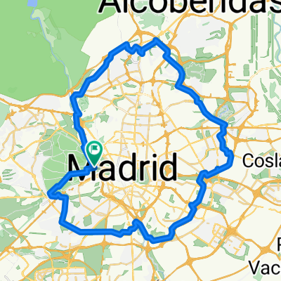
A cycling route starting in Moncloa-Aravaca, Madrid, Spain.
Overview
About this route
Aquí os dejo el sector de BTT del próximo X-Mountain Hitachi, a celebrar en La Casa de Campo el próximo 6 de septiembre para que alguno lo entrene.
No tiene mucha complicación. Subidas largas por pistas, senderos ratoneros en bajada sin problemas y un repechón duro, pero que se sube si se hace el cambio a tiempo y se aprieta el culo. Va por debajo del teleférico y sale desde la Fuente del Pajarito, la que está en la Glorieta de las Moreras.- -:--
- Duration
- 9.9 km
- Distance
- 117 m
- Ascent
- 117 m
- Descent
- ---
- Avg. speed
- ---
- Max. altitude

Route highlights
Points of interest along the route
Point of interest after 9.1 km
Fuente del Pajarito
Continue with Bikemap
Use, edit, or download this cycling route
You would like to ride Triathlon X-Mountain Hitachi Madrid 2014 or customize it for your own trip? Here is what you can do with this Bikemap route:
Free features
- Save this route as favorite or in collections
- Copy & plan your own version of this route
- Sync your route with Garmin or Wahoo
Premium features
Free trial for 3 days, or one-time payment. More about Bikemap Premium.
- Navigate this route on iOS & Android
- Export a GPX / KML file of this route
- Create your custom printout (try it for free)
- Download this route for offline navigation
Discover more Premium features.
Get Bikemap PremiumFrom our community
Other popular routes starting in Moncloa-Aravaca
 CasaCampoCorta
- Distance
- 12.8 km
- Ascent
- 117 m
- Descent
- 117 m
- Location
- Moncloa-Aravaca, Madrid, Spain
 Ruta de los caches de la casa de campo
- Distance
- 24.4 km
- Ascent
- 199 m
- Descent
- 182 m
- Location
- Moncloa-Aravaca, Madrid, Spain
 Anillo Verde Ciclista
- Distance
- 62.1 km
- Ascent
- 334 m
- Descent
- 280 m
- Location
- Moncloa-Aravaca, Madrid, Spain
 casa de campo compartir
- Distance
- 17.8 km
- Ascent
- 225 m
- Descent
- 231 m
- Location
- Moncloa-Aravaca, Madrid, Spain
 Casa de Campo - El Pardo - Embalse de El Pardo
- Distance
- 47.6 km
- Ascent
- 240 m
- Descent
- 236 m
- Location
- Moncloa-Aravaca, Madrid, Spain
 parque del retiro -cas de campo ... Madrid.. . busca ciclovias por la aplicación Bikemap...
- Distance
- 8.3 km
- Ascent
- 142 m
- Descent
- 121 m
- Location
- Moncloa-Aravaca, Madrid, Spain
 Madrid-Cercedilla-Guadarrama-El Escorial-Madrid
- Distance
- 164.2 km
- Ascent
- 1,565 m
- Descent
- 1,580 m
- Location
- Moncloa-Aravaca, Madrid, Spain
 Casa de Campo
- Distance
- 33.4 km
- Ascent
- 359 m
- Descent
- 359 m
- Location
- Moncloa-Aravaca, Madrid, Spain
Open it in the app