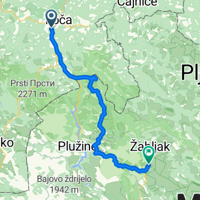
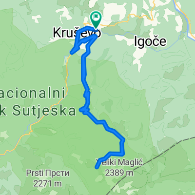
201_08_Foča_EtnoSelo
A cycling route starting in Foča, Republika Srpska, Bosnia and Herzegovina.
Overview
About this route
Balkan Express 2015: Vrhnika - Drač
- -:--
- Duration
- 77.1 km
- Distance
- 1,555 m
- Ascent
- 995 m
- Descent
- ---
- Avg. speed
- ---
- Max. altitude
Route quality
Waytypes & surfaces along the route
Waytypes
Quiet road
4.6 km
(6 %)
Track
2.3 km
(3 %)
Surfaces
Paved
69.3 km
(90 %)
Unpaved
3.1 km
(4 %)
Asphalt
69.3 km
(90 %)
Sand
2.3 km
(3 %)
Continue with Bikemap
Use, edit, or download this cycling route
You would like to ride 201_08_Foča_EtnoSelo or customize it for your own trip? Here is what you can do with this Bikemap route:
Free features
- Save this route as favorite or in collections
- Copy & plan your own version of this route
- Sync your route with Garmin or Wahoo
Premium features
Free trial for 3 days, or one-time payment. More about Bikemap Premium.
- Navigate this route on iOS & Android
- Export a GPX / KML file of this route
- Create your custom printout (try it for free)
- Download this route for offline navigation
Discover more Premium features.
Get Bikemap PremiumFrom our community
Other popular routes starting in Foča
- 2 (MNE-wersja2)
- Distance
- 298.5 km
- Ascent
- 2,905 m
- Descent
- 3,253 m
- Location
- Foča, Republika Srpska, Bosnia and Herzegovina
- Tjentiste-Orlovacko jezero-Cemerno-Tjentiste-3
- Distance
- 86.9 km
- Ascent
- 2,320 m
- Descent
- 2,274 m
- Location
- Foča, Republika Srpska, Bosnia and Herzegovina
- Zelengora 2016
- Distance
- 59.9 km
- Ascent
- 2,092 m
- Descent
- 1,180 m
- Location
- Foča, Republika Srpska, Bosnia and Herzegovina
- 201_08_Foča_EtnoSelo
- Distance
- 77.1 km
- Ascent
- 1,555 m
- Descent
- 995 m
- Location
- Foča, Republika Srpska, Bosnia and Herzegovina
- tjentiste.durmitor 5 tappa
- Distance
- 120 km
- Ascent
- 2,318 m
- Descent
- 1,576 m
- Location
- Foča, Republika Srpska, Bosnia and Herzegovina
- Plijes
- Distance
- 48.9 km
- Ascent
- 1,673 m
- Descent
- 1,679 m
- Location
- Foča, Republika Srpska, Bosnia and Herzegovina
- Tjentiste-Orlovacko jezero-Cemerno-Tjentiste-2
- Distance
- 81.2 km
- Ascent
- 2,150 m
- Descent
- 2,142 m
- Location
- Foča, Republika Srpska, Bosnia and Herzegovina
- Tjentiste-Orlovacko jezero-Cemerno-Tjentiste-1
- Distance
- 94.8 km
- Ascent
- 2,361 m
- Descent
- 2,353 m
- Location
- Foča, Republika Srpska, Bosnia and Herzegovina
Open it in the app