

Steinheim - Heilbronn
A cycling route starting in Steinheim am der Murr, Baden-Württemberg, Germany.
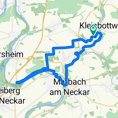
Overview
About this route
Von Steinheim über den Alb-Neckar-Weg Richtung Heilbronn und am Neckar entlang wieder zurück
- -:--
- Duration
- 62.9 km
- Distance
- 348 m
- Ascent
- 393 m
- Descent
- ---
- Avg. speed
- 289 m
- Max. altitude
Route quality
Waytypes & surfaces along the route
Waytypes
Quiet road
19.8 km
(31 %)
Track
16.2 km
(26 %)
Surfaces
Paved
52 km
(83 %)
Unpaved
7.3 km
(12 %)
Asphalt
48.6 km
(77 %)
Loose gravel
4 km
(6 %)
Continue with Bikemap
Use, edit, or download this cycling route
You would like to ride Steinheim - Heilbronn or customize it for your own trip? Here is what you can do with this Bikemap route:
Free features
- Save this route as favorite or in collections
- Copy & plan your own version of this route
- Sync your route with Garmin or Wahoo
Premium features
Free trial for 3 days, or one-time payment. More about Bikemap Premium.
- Navigate this route on iOS & Android
- Export a GPX / KML file of this route
- Create your custom printout (try it for free)
- Download this route for offline navigation
Discover more Premium features.
Get Bikemap PremiumFrom our community
Other popular routes starting in Steinheim am der Murr
 Feierabendausfahrt
- Distance
- 36.1 km
- Ascent
- 413 m
- Descent
- 412 m
- Location
- Steinheim am der Murr, Baden-Württemberg, Germany
 Weinberge, Wald und Felder
- Distance
- 26.2 km
- Ascent
- 387 m
- Descent
- 376 m
- Location
- Steinheim am der Murr, Baden-Württemberg, Germany
 Rundtour Steinheim - Oppenweiler
- Distance
- 49.6 km
- Ascent
- 661 m
- Descent
- 661 m
- Location
- Steinheim am der Murr, Baden-Württemberg, Germany
 Von Steinheim nach Kornwestheim; Variante 2
- Distance
- 20.3 km
- Ascent
- 236 m
- Descent
- 183 m
- Location
- Steinheim am der Murr, Baden-Württemberg, Germany
 Mittlere Trainingsrunde
- Distance
- 19.6 km
- Ascent
- 84 m
- Descent
- 113 m
- Location
- Steinheim am der Murr, Baden-Württemberg, Germany
 Große Traningsrunde
- Distance
- 43.8 km
- Ascent
- 409 m
- Descent
- 417 m
- Location
- Steinheim am der Murr, Baden-Württemberg, Germany
 Marbach-Freiberg-Markgröningen-Unterriexingen-Bietigheim
- Distance
- 54.3 km
- Ascent
- 504 m
- Descent
- 509 m
- Location
- Steinheim am der Murr, Baden-Württemberg, Germany
 Kleine Trainingsrunde
- Distance
- 11.9 km
- Ascent
- 80 m
- Descent
- 81 m
- Location
- Steinheim am der Murr, Baden-Württemberg, Germany
Open it in the app