

Cow Bay Loop
A cycling route starting in Dartmouth, Nova Scotia, Canada.
Overview
About this route
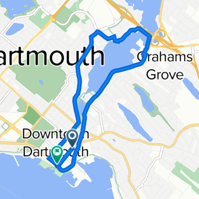
Starting at the Dartmouth-end of the MacDonald Bridge, the route starts through downtown Dartmouth and out towards to Eastern Shore area. It cuts inland after a time and has the rider climb up towards the community of Cow Bay before heading back west through the Forest Hills area and back to downtown Dartmouth. I ended this loop at Alderny Landing (Dartmouth Ferry Terminal), allowing the rider to enjoy downtown Dartmouth, or take the ferry back to Halifax-proper. This route is quite close to being half-drawn-out-climb and half-downhill-coast.
- -:--
- Duration
- 33.9 km
- Distance
- 242 m
- Ascent
- 268 m
- Descent
- ---
- Avg. speed
- ---
- Max. altitude

Route quality
Waytypes & surfaces along the route
Waytypes
Busy road
30.9 km
(91 %)
Access road
1.4 km
(4 %)
Surfaces
Paved
32.6 km
(96 %)
Unpaved
0.4 km
(1 %)
Asphalt
17.7 km
(52 %)
Paved (undefined)
14.9 km
(44 %)
Continue with Bikemap
Use, edit, or download this cycling route
You would like to ride Cow Bay Loop or customize it for your own trip? Here is what you can do with this Bikemap route:
Free features
- Save this route as favorite or in collections
- Copy & plan your own version of this route
- Sync your route with Garmin or Wahoo
Premium features
Free trial for 3 days, or one-time payment. More about Bikemap Premium.
- Navigate this route on iOS & Android
- Export a GPX / KML file of this route
- Create your custom printout (try it for free)
- Download this route for offline navigation
Discover more Premium features.
Get Bikemap PremiumFrom our community
Other popular routes starting in Dartmouth
 207
207- Distance
- 70.9 km
- Ascent
- 331 m
- Descent
- 331 m
- Location
- Dartmouth, Nova Scotia, Canada
 Day 1 - Cycle NS East
- Distance
- 277.6 km
- Ascent
- 513 m
- Descent
- 522 m
- Location
- Dartmouth, Nova Scotia, Canada
 Sullivan's to Charles Loop
- Distance
- 18.6 km
- Ascent
- 123 m
- Descent
- 123 m
- Location
- Dartmouth, Nova Scotia, Canada
 30 min lake banook
- Distance
- 6.9 km
- Ascent
- 84 m
- Descent
- 87 m
- Location
- Dartmouth, Nova Scotia, Canada
 Dartmouth02
- Distance
- 45.7 km
- Ascent
- 291 m
- Descent
- 291 m
- Location
- Dartmouth, Nova Scotia, Canada
 Citadel Hill Ride
- Distance
- 9.5 km
- Ascent
- 88 m
- Descent
- 92 m
- Location
- Dartmouth, Nova Scotia, Canada
 Shubie to Woodside Loop
- Distance
- 18.5 km
- Ascent
- 165 m
- Descent
- 166 m
- Location
- Dartmouth, Nova Scotia, Canada
 Easy ride
- Distance
- 6.8 km
- Ascent
- 36 m
- Descent
- 97 m
- Location
- Dartmouth, Nova Scotia, Canada
Open it in the app