

Hydalen
A cycling route starting in Hemsedal, Buskerud, Norway.
Overview
About this route
<span style="font-size: 8.5pt; color: black; font-family: HelveticaNeue-HeavyCond;">Hydalen</span>
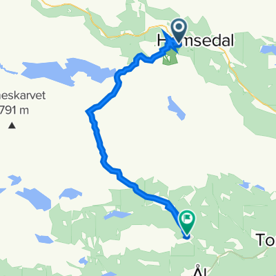
<span style="font-size: 8.5pt; color: black; font-family: HelveticaNeue-LightCond;">Start at the parking at Fjellstølane, alternative Vavatn/Oset (toll road for cars NOK 40). Bike</span>
<span style="font-size: 8.5pt; color: black; font-family: HelveticaNeue-LightCond;">alongside Vavatnet until it turns into Vaboleino. Follow the road that goes down</span>
<span style="font-size: 8.5pt; color: black; font-family: HelveticaNeue-LightCond;">Hydalen (about 250 m gradient). A beautiful area, surrounded by steep mountains</span>
<span style="font-size: 8.5pt; color: black; font-family: HelveticaNeue-LightCond;">and with a rich and distinctive fauna. Also possible to buy a fishing licence and</span>
<span style="font-size: 8.5pt; color: black; font-family: HelveticaNeue-LightCond;">try your luck for a catch, or take a swim in the calm waters in Hydalen or in the stream along the road.</span>
<span style="font-size: 8.5pt; color: black; font-family: HelveticaNeue-LightCond;">Top 20 peaks you may walk from this route are Kvitingatn, Harahødn and Ranastøngji.</span>
<span style="font-size: 8.5pt; color: black; font-family: HelveticaNeue-HeavyCond;"> </span>
(cloned from route 1074106)
- -:--
- Duration
- 12.1 km
- Distance
- 333 m
- Ascent
- 498 m
- Descent
- ---
- Avg. speed
- ---
- Max. altitude
Route quality
Waytypes & surfaces along the route
Waytypes
Quiet road
12 km
(99 %)
Access road
0.2 km
(1 %)
Continue with Bikemap
Use, edit, or download this cycling route
You would like to ride Hydalen or customize it for your own trip? Here is what you can do with this Bikemap route:
Free features
- Save this route as favorite or in collections
- Copy & plan your own version of this route
- Sync your route with Garmin or Wahoo
Premium features
Free trial for 3 days, or one-time payment. More about Bikemap Premium.
- Navigate this route on iOS & Android
- Export a GPX / KML file of this route
- Create your custom printout (try it for free)
- Download this route for offline navigation
Discover more Premium features.
Get Bikemap PremiumFrom our community
Other popular routes starting in Hemsedal
 Hemsedal 2
- Distance
- 58.3 km
- Ascent
- 858 m
- Descent
- 876 m
- Location
- Hemsedal, Buskerud, Norway
 Hemsedal Totten
- Distance
- 24.8 km
- Ascent
- 0 m
- Descent
- 0 m
- Location
- Hemsedal, Buskerud, Norway
 Hemsedalsvegen 3533, Hemsedal do Hemsedalsvegen 3536, Hemsedal
- Distance
- 27.9 km
- Ascent
- 1,206 m
- Descent
- 1,204 m
- Location
- Hemsedal, Buskerud, Norway
 Hemsedal (Holdeskaret)-Vats-Geilo
- Distance
- 70.9 km
- Ascent
- 1,071 m
- Descent
- 1,377 m
- Location
- Hemsedal, Buskerud, Norway
 Hemsedal - Ål
- Distance
- 37 km
- Ascent
- 686 m
- Descent
- 832 m
- Location
- Hemsedal, Buskerud, Norway
 Kljåen
- Distance
- 10.3 km
- Ascent
- 839 m
- Descent
- 743 m
- Location
- Hemsedal, Buskerud, Norway
 Kongevegen
- Distance
- 18.4 km
- Ascent
- 1,526 m
- Descent
- 1,352 m
- Location
- Hemsedal, Buskerud, Norway
 Hemsedal
- Distance
- 52.6 km
- Ascent
- 1,042 m
- Descent
- 1,042 m
- Location
- Hemsedal, Buskerud, Norway
Open it in the app