
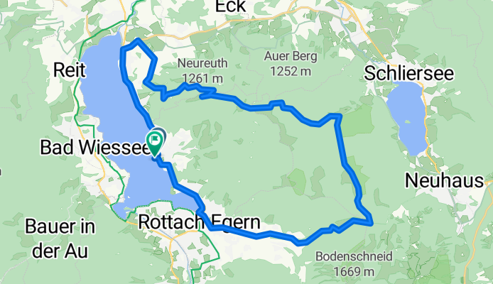
Bergtour am Tegernsee
A cycling route starting in Tegernsee, Bavaria, Germany.
Overview
About this route
Start quite steep, short push section at the end, great view at the top
- -:--
- Duration
- 28.4 km
- Distance
- 857 m
- Ascent
- 858 m
- Descent
- ---
- Avg. speed
- ---
- Max. altitude
Continue with Bikemap
Use, edit, or download this cycling route
You would like to ride Bergtour am Tegernsee or customize it for your own trip? Here is what you can do with this Bikemap route:
Free features
- Save this route as favorite or in collections
- Copy & plan your own version of this route
- Sync your route with Garmin or Wahoo
Premium features
Free trial for 3 days, or one-time payment. More about Bikemap Premium.
- Navigate this route on iOS & Android
- Export a GPX / KML file of this route
- Create your custom printout (try it for free)
- Download this route for offline navigation
Discover more Premium features.
Get Bikemap PremiumFrom our community
Other popular routes starting in Tegernsee
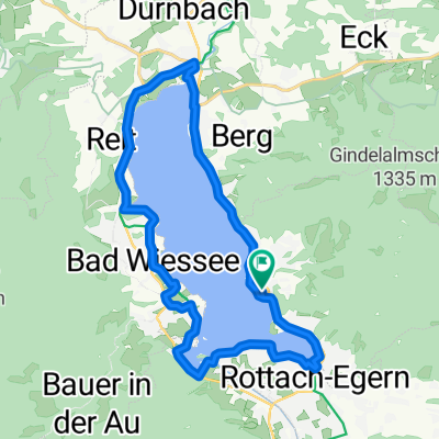
 Höhenweg Rottach Runde
- Distance
- 11.4 km
- Ascent
- 297 m
- Descent
- 297 m
- Location
- Tegernsee, Bavaria, Germany
 Seestraße nach Bahnhofplatz
- Distance
- 25.1 km
- Ascent
- 226 m
- Descent
- 284 m
- Location
- Tegernsee, Bavaria, Germany
 Seerundweg Tegernsee (Tour Nr. 32 aus dem"RadlTraum Süd")
- Distance
- 20.9 km
- Ascent
- 139 m
- Descent
- 140 m
- Location
- Tegernsee, Bavaria, Germany
 Bergtour am Tegernsee
- Distance
- 28.4 km
- Ascent
- 857 m
- Descent
- 858 m
- Location
- Tegernsee, Bavaria, Germany
 Rundfahrt von Tegernsee Bhf über Kreuzberg
- Distance
- 5.8 km
- Ascent
- 530 m
- Descent
- 80 m
- Location
- Tegernsee, Bavaria, Germany
 Tegernsee /Schliersee
- Distance
- 45.8 km
- Ascent
- 1,674 m
- Descent
- 1,674 m
- Location
- Tegernsee, Bavaria, Germany
 Gindelalm
- Distance
- 11.8 km
- Ascent
- 635 m
- Descent
- 637 m
- Location
- Tegernsee, Bavaria, Germany
 Seestraße nach Straße Ohne Straßennamen
- Distance
- 35.3 km
- Ascent
- 657 m
- Descent
- 329 m
- Location
- Tegernsee, Bavaria, Germany
Open it in the app