

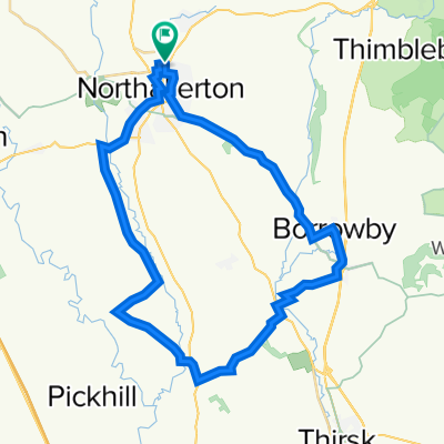
Over Silton, Black hambleton, Death Valley, Arden Forest, Arden Hall
A cycling route starting in Northallerton, England, United Kingdom.
Overview
About this route
Mountain Bike Trail
(cloned from route 2778830)- -:--
- Duration
- 23.8 km
- Distance
- 520 m
- Ascent
- 521 m
- Descent
- ---
- Avg. speed
- ---
- Max. altitude

Route quality
Waytypes & surfaces along the route
Waytypes
Track
18.8 km
(79 %)
Quiet road
2.3 km
(10 %)
Surfaces
Paved
2.7 km
(11 %)
Unpaved
20.1 km
(84 %)
Gravel
18.1 km
(76 %)
Asphalt
2.7 km
(11 %)
Continue with Bikemap
Use, edit, or download this cycling route
You would like to ride Over Silton, Black hambleton, Death Valley, Arden Forest, Arden Hall or customize it for your own trip? Here is what you can do with this Bikemap route:
Free features
- Save this route as favorite or in collections
- Copy & plan your own version of this route
- Sync your route with Garmin or Wahoo
Premium features
Free trial for 3 days, or one-time payment. More about Bikemap Premium.
- Navigate this route on iOS & Android
- Export a GPX / KML file of this route
- Create your custom printout (try it for free)
- Download this route for offline navigation
Discover more Premium features.
Get Bikemap PremiumFrom our community
Other popular routes starting in Northallerton
 Town Hall Buildings, Northallerton to Reeth Road, Stockton-On-Tees
- Distance
- 39.9 km
- Ascent
- 137 m
- Descent
- 158 m
- Location
- Northallerton, England, United Kingdom
 Broomfield to Stone Cross
- Distance
- 8.3 km
- Ascent
- 143 m
- Descent
- 164 m
- Location
- Northallerton, England, United Kingdom
 return route from Friarage via Ainderby Steaple
- Distance
- 26.8 km
- Ascent
- 152 m
- Descent
- 42 m
- Location
- Northallerton, England, United Kingdom
 51k new route
- Distance
- 52 km
- Ascent
- 101 m
- Descent
- 100 m
- Location
- Northallerton, England, United Kingdom
 Over Silton, Black hambleton, Death Valley, Arden Forest, Arden Hall
- Distance
- 23.8 km
- Ascent
- 520 m
- Descent
- 521 m
- Location
- Northallerton, England, United Kingdom
 21 mile loop from hotel
- Distance
- 34 km
- Ascent
- 227 m
- Descent
- 225 m
- Location
- Northallerton, England, United Kingdom
 Round Northallerton
- Distance
- 62.5 km
- Ascent
- 300 m
- Descent
- 308 m
- Location
- Northallerton, England, United Kingdom
 Maunby and Estate
- Distance
- 34.1 km
- Ascent
- 188 m
- Descent
- 187 m
- Location
- Northallerton, England, United Kingdom
Open it in the app