

Brocken ab Thale mit Abstecher nach Westdeutschland
A cycling route starting in Thale, Saxony-Anhalt, Germany.
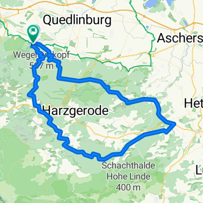
Overview
About this route
<div class="routedescription ">
Alles auf asphaltierten und meist autoarmen Straßen. Pausenmöglichkeiten u.a. in Benneckenstein. Kurzes Stück mit 13% an der Roßtrappe; kurzes Stück mit 15% am Brocken, etwa 200m vor dem Gipfel. Die Route ist zwar recht autoarm, aber leider nicht autofrei. Viele Autofahrer(innen) im Harz scheinen an einem Totalausfall des Gehirns zu leiden - mit 50 cm Abstand und in/vor Kurven wurden wir häufiger (gemessen an der Zahl der Autos) überholt. Besser also möglichst weit links fahren, dann können sie das zumindest nicht machen, während sie auch noch Kfz-Ggegenverkehr haben.</div>
- -:--
- Duration
- 127.7 km
- Distance
- 1,694 m
- Ascent
- 1,694 m
- Descent
- ---
- Avg. speed
- ---
- Max. altitude

Route quality
Waytypes & surfaces along the route
Waytypes
Busy road
62.7 km
(49 %)
Road
31.3 km
(25 %)
Surfaces
Paved
117.8 km
(92 %)
Unpaved
2 km
(2 %)
Asphalt
116.7 km
(91 %)
Gravel
0.9 km
(<1 %)
Route highlights
Points of interest along the route
Point of interest after 38.5 km
Pausenmöglichkeiten
Continue with Bikemap
Use, edit, or download this cycling route
You would like to ride Brocken ab Thale mit Abstecher nach Westdeutschland or customize it for your own trip? Here is what you can do with this Bikemap route:
Free features
- Save this route as favorite or in collections
- Copy & plan your own version of this route
- Split it into stages to create a multi-day tour
- Sync your route with Garmin or Wahoo
Premium features
Free trial for 3 days, or one-time payment. More about Bikemap Premium.
- Navigate this route on iOS & Android
- Export a GPX / KML file of this route
- Create your custom printout (try it for free)
- Download this route for offline navigation
Discover more Premium features.
Get Bikemap PremiumFrom our community
Other popular routes starting in Thale
 Connis Route
- Distance
- 38.7 km
- Ascent
- 812 m
- Descent
- 812 m
- Location
- Thale, Saxony-Anhalt, Germany
 Harz 2010 01
- Distance
- 83.5 km
- Ascent
- 964 m
- Descent
- 964 m
- Location
- Thale, Saxony-Anhalt, Germany
 Roßtrappenstraße 79, Thale nach Roßtrappenstraße 79, Thale
- Distance
- 18.3 km
- Ascent
- 55 m
- Descent
- 26 m
- Location
- Thale, Saxony-Anhalt, Germany
 Brocken ab Thale, autoarm
- Distance
- 114.2 km
- Ascent
- 1,359 m
- Descent
- 1,359 m
- Location
- Thale, Saxony-Anhalt, Germany
 Thale _ Braunlage
- Distance
- 105.4 km
- Ascent
- 1,187 m
- Descent
- 1,187 m
- Location
- Thale, Saxony-Anhalt, Germany
 Thale Klostercamping - stolelift til Rostreppe
- Distance
- 3.3 km
- Ascent
- 33 m
- Descent
- 4 m
- Location
- Thale, Saxony-Anhalt, Germany
 Brocken ab Thale mit Abstecher nach Westdeutschland
- Distance
- 127.7 km
- Ascent
- 1,694 m
- Descent
- 1,694 m
- Location
- Thale, Saxony-Anhalt, Germany
 97 1610 Thale Biesen Wippra FBR
- Distance
- 96.7 km
- Ascent
- 1,148 m
- Descent
- 1,145 m
- Location
- Thale, Saxony-Anhalt, Germany
Open it in the app