

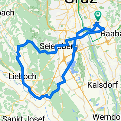
pachern-steinberg-laßnitzhöhe-nestelbachberg-nestelbach-vasoldsberg-gössendorf
A cycling route starting in Raaba, Styria, Austria.
Overview
About this route
the ascent to Steinberg is relatively steep and long, then a slight up and down until Lassnitzhöhe, over Greimelweg and Nestelbachberg towards Mitterlassnitz, beautiful area and view, from Nestelbachberg the road is relatively poor and the descent is bumpy and narrow, continue to Nestelbach and there the second ascent, this one is less steep but also long, from Schemerlhöhe to Vasoldsberg mostly downhill with a nice descent, from Vasoldsberg to Hausmannstätten a nice road and good for rolling
- -:--
- Duration
- 41.8 km
- Distance
- 338 m
- Ascent
- 337 m
- Descent
- ---
- Avg. speed
- ---
- Max. altitude
Route quality
Waytypes & surfaces along the route
Waytypes
Road
10 km
(24 %)
Quiet road
8.8 km
(21 %)
Surfaces
Paved
30.5 km
(73 %)
Unpaved
0.4 km
(1 %)
Asphalt
30.5 km
(73 %)
Ground
0.4 km
(1 %)
Undefined
10.9 km
(26 %)
Continue with Bikemap
Use, edit, or download this cycling route
You would like to ride pachern-steinberg-laßnitzhöhe-nestelbachberg-nestelbach-vasoldsberg-gössendorf or customize it for your own trip? Here is what you can do with this Bikemap route:
Free features
- Save this route as favorite or in collections
- Copy & plan your own version of this route
- Sync your route with Garmin or Wahoo
Premium features
Free trial for 3 days, or one-time payment. More about Bikemap Premium.
- Navigate this route on iOS & Android
- Export a GPX / KML file of this route
- Create your custom printout (try it for free)
- Download this route for offline navigation
Discover more Premium features.
Get Bikemap PremiumFrom our community
Other popular routes starting in Raaba
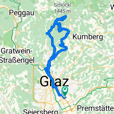 Schöckl (ab Waller-Hütte Weg 730)
- Distance
- 57.6 km
- Ascent
- 1,247 m
- Descent
- 1,247 m
- Location
- Raaba, Styria, Austria
 ragnitz-ries1
- Distance
- 19 km
- Ascent
- 271 m
- Descent
- 273 m
- Location
- Raaba, Styria, Austria
 Fahrwoche 2013 - 3.Ausfahrt
- Distance
- 109.8 km
- Ascent
- 694 m
- Descent
- 714 m
- Location
- Raaba, Styria, Austria
 Graz St. Peter nach Feldbach
- Distance
- 61.3 km
- Ascent
- 255 m
- Descent
- 365 m
- Location
- Raaba, Styria, Austria
 44km roundtri[
- Distance
- 45 km
- Ascent
- 355 m
- Descent
- 354 m
- Location
- Raaba, Styria, Austria
 St. Peter - Verlängerung Wolfsgraben
- Distance
- 9.9 km
- Ascent
- 237 m
- Descent
- 238 m
- Location
- Raaba, Styria, Austria
 pachern-steinberg-laßnitzhöhe-nestelbachberg-nestelbach-vasoldsberg-gössendorf
- Distance
- 41.8 km
- Ascent
- 338 m
- Descent
- 337 m
- Location
- Raaba, Styria, Austria
 hohenrain-rastbühel-kainbach-eggersdorf-prellerberg-schaftal
- Distance
- 39.4 km
- Ascent
- 433 m
- Descent
- 436 m
- Location
- Raaba, Styria, Austria
Open it in the app