

Easy 21 miler
A cycling route starting in Fall River, Massachusetts, United States.
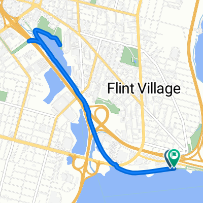
Overview
About this route
decent ride. Some hills.
(cloned from route 2781810)- -:--
- Duration
- 33.9 km
- Distance
- 109 m
- Ascent
- 109 m
- Descent
- ---
- Avg. speed
- ---
- Max. altitude

Route quality
Waytypes & surfaces along the route
Waytypes
Busy road
25.1 km
(74 %)
Quiet road
6.1 km
(18 %)
Surfaces
Paved
2 km
(6 %)
Unpaved
0 km
(<1 %)
Asphalt
1.8 km
(5 %)
Concrete
0.2 km
(<1 %)
Continue with Bikemap
Use, edit, or download this cycling route
You would like to ride Easy 21 miler or customize it for your own trip? Here is what you can do with this Bikemap route:
Free features
- Save this route as favorite or in collections
- Copy & plan your own version of this route
- Sync your route with Garmin or Wahoo
Premium features
Free trial for 3 days, or one-time payment. More about Bikemap Premium.
- Navigate this route on iOS & Android
- Export a GPX / KML file of this route
- Create your custom printout (try it for free)
- Download this route for offline navigation
Discover more Premium features.
Get Bikemap PremiumFrom our community
Other popular routes starting in Fall River
 Quequechan Rail Trail, Fall River to 197–199 Wordell St, Fall River
- Distance
- 2.5 km
- Ascent
- 10 m
- Descent
- 9 m
- Location
- Fall River, Massachusetts, United States
 469–555 Spring St, Fall River to 454 Main Rd, Tiverton
- Distance
- 5.7 km
- Ascent
- 58 m
- Descent
- 113 m
- Location
- Fall River, Massachusetts, United States
 1111111
- Distance
- 6.9 km
- Ascent
- 1,832 m
- Descent
- 1,783 m
- Location
- Fall River, Massachusetts, United States
 Cottage Street 16, Fall River to Broadway 829, Fall River
- Distance
- 1.1 km
- Ascent
- 15 m
- Descent
- 9 m
- Location
- Fall River, Massachusetts, United States
 Easy ride in Fall River
- Distance
- 5.8 km
- Ascent
- 64 m
- Descent
- 48 m
- Location
- Fall River, Massachusetts, United States
 Relaxed route in Fall River
- Distance
- 6.8 km
- Ascent
- 40 m
- Descent
- 40 m
- Location
- Fall River, Massachusetts, United States
 Recovered Route
- Distance
- 55.8 km
- Ascent
- 73 m
- Descent
- 119 m
- Location
- Fall River, Massachusetts, United States
 Martine St, Fall River to Quequechan River Regional, Fall River
- Distance
- 7 km
- Ascent
- 10 m
- Descent
- 14 m
- Location
- Fall River, Massachusetts, United States
Open it in the app