U'dorf-Lu'felde
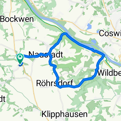
A cycling route starting in Klipphausen, Saxony, Germany.
Overview
About this route
von Ullendorf nach Hause
- -:--
- Duration
- 172.4 km
- Distance
- 192 m
- Ascent
- 391 m
- Descent
- ---
- Avg. speed
- ---
- Max. altitude
Route quality
Waytypes & surfaces along the route
Waytypes
Busy road
79.7 km
(46 %)
Road
34.1 km
(20 %)
Surfaces
Paved
142.2 km
(83 %)
Unpaved
7.4 km
(4 %)
Asphalt
130.7 km
(76 %)
Gravel
6.6 km
(4 %)
Continue with Bikemap
Use, edit, or download this cycling route
You would like to ride U'dorf-Lu'felde or customize it for your own trip? Here is what you can do with this Bikemap route:
Free features
- Save this route as favorite or in collections
- Copy & plan your own version of this route
- Split it into stages to create a multi-day tour
- Sync your route with Garmin or Wahoo
Premium features
Free trial for 3 days, or one-time payment. More about Bikemap Premium.
- Navigate this route on iOS & Android
- Export a GPX / KML file of this route
- Create your custom printout (try it for free)
- Download this route for offline navigation
Discover more Premium features.
Get Bikemap PremiumFrom our community
Other popular routes starting in Klipphausen
- robert1
- Distance
- 11.5 km
- Ascent
- 64 m
- Descent
- 46 m
- Location
- Klipphausen, Saxony, Germany
- Taubenheim, Sora, Klipphausen, Cossebaude, Constappel, Kleinschönberg, Klipphausen, Taubenheim18.08.2013
- Distance
- 37.3 km
- Ascent
- 332 m
- Descent
- 338 m
- Location
- Klipphausen, Saxony, Germany
- U'dorf-Lu'felde
- Distance
- 172.4 km
- Ascent
- 192 m
- Descent
- 391 m
- Location
- Klipphausen, Saxony, Germany
- Herz über Kopf in Meißen und Klipphausen
- Distance
- 34.4 km
- Ascent
- 309 m
- Descent
- 310 m
- Location
- Klipphausen, Saxony, Germany
- Stoppomat - Zeitmessstrecke Gauernitz
- Distance
- 4.6 km
- Ascent
- 160 m
- Descent
- 20 m
- Location
- Klipphausen, Saxony, Germany
- 2014-04-06
- Distance
- 14 km
- Ascent
- 144 m
- Descent
- 144 m
- Location
- Klipphausen, Saxony, Germany
- Ullendorf-Ludwigsfelde
- Distance
- 173.5 km
- Ascent
- 229 m
- Descent
- 428 m
- Location
- Klipphausen, Saxony, Germany
- Taubenheim, Riemsdorf, Naustadt, Gauernitz, Constappel, Kleinschönberg, Klipphausen, Röhrsdorf, Taubenheim
- Distance
- 23.1 km
- Ascent
- 240 m
- Descent
- 240 m
- Location
- Klipphausen, Saxony, Germany
Open it in the app