

Zabelsteinrunde
A cycling route starting in Gädheim, Bavaria, Germany.
Overview
About this route
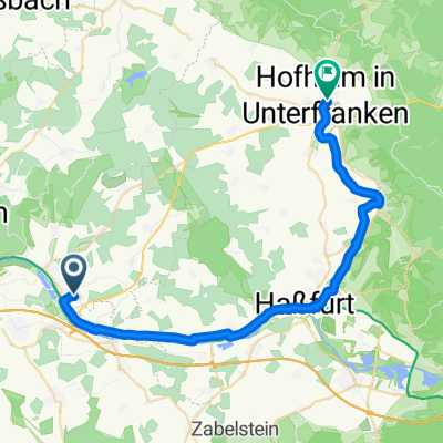
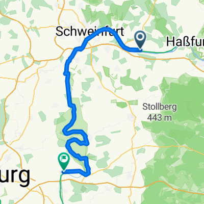
Start: Obereuerheim
Destination: Obereuerheim
Route: From Obereuerheim towards Horhausen on a gravel path through the woods. Pass the Stalsmühle, continuing on the dirt path towards Steinsfeld. In Steinsfeld, pass the forest chapel towards Reinhardswinden and then to Wohnau. From Wohnau, ascend to Zabelstein and from there to Heinachshof with a small loop towards Neuhausen and back to Zabelstein. Descent via Zabelsteinstraße to Neuhof. Through the Traustädter forest to Kleinrheinfeld. Passing the old Truben practice field to Dürrfeld and back to Obereuerheim.
- -:--
- Duration
- 41.9 km
- Distance
- 625 m
- Ascent
- 573 m
- Descent
- ---
- Avg. speed
- 495 m
- Max. altitude
Route quality
Waytypes & surfaces along the route
Waytypes
Track
30.6 km
(73 %)
Road
4.2 km
(10 %)
Surfaces
Paved
6.7 km
(16 %)
Unpaved
25.6 km
(61 %)
Gravel
13.4 km
(32 %)
Ground
6.3 km
(15 %)
Continue with Bikemap
Use, edit, or download this cycling route
You would like to ride Zabelsteinrunde or customize it for your own trip? Here is what you can do with this Bikemap route:
Free features
- Save this route as favorite or in collections
- Copy & plan your own version of this route
- Sync your route with Garmin or Wahoo
Premium features
Free trial for 3 days, or one-time payment. More about Bikemap Premium.
- Navigate this route on iOS & Android
- Export a GPX / KML file of this route
- Create your custom printout (try it for free)
- Download this route for offline navigation
Discover more Premium features.
Get Bikemap PremiumFrom our community
Other popular routes starting in Gädheim
 Langsame Fahrt in
- Distance
- 31.1 km
- Ascent
- 102 m
- Descent
- 107 m
- Location
- Gädheim, Bavaria, Germany
 Nürnberg - Koblenz Etappe 4/13
- Distance
- 61.6 km
- Ascent
- 151 m
- Descent
- 194 m
- Location
- Gädheim, Bavaria, Germany
 Zabelsteinrunde
- Distance
- 41.9 km
- Ascent
- 625 m
- Descent
- 573 m
- Location
- Gädheim, Bavaria, Germany
 Wiesenstraße 5, Schonungen nach Ringstraße 2–4, Hofheim in Unterfranken
- Distance
- 32.8 km
- Ascent
- 191 m
- Descent
- 189 m
- Location
- Gädheim, Bavaria, Germany
 Vom Maintal in den Steigerwald
- Distance
- 52.3 km
- Ascent
- 359 m
- Descent
- 360 m
- Location
- Gädheim, Bavaria, Germany
 main-route
- Distance
- 77.1 km
- Ascent
- 400 m
- Descent
- 404 m
- Location
- Gädheim, Bavaria, Germany
 Einfache Fahrt in
- Distance
- 14.8 km
- Ascent
- 176 m
- Descent
- 176 m
- Location
- Gädheim, Bavaria, Germany
 Etappe_05_bike
- Distance
- 62.7 km
- Ascent
- 133 m
- Descent
- 177 m
- Location
- Gädheim, Bavaria, Germany
Open it in the app