SV to downtown
A cycling route starting in Carrboro, North Carolina, United States.
Overview
About this route
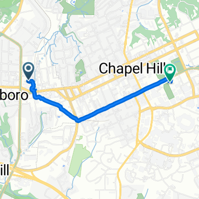
This is a direct way to get from Southern Village to downtown - in this case to the town hall.
The first part is very pleasant following the Fan Branch and Morgan Creek trails to the parking lot at the Morgan Creek trail head on NC54. From there you have to ride ~200 yrds along NC54 on the [very] wide shoulder and cross over to the apartments and climb a short but pretty steep hill. You connect to Edwards St via a gate next to the tennis courts and climb a little more until you reach Merritt Mill Rd from which point on it gets flatter again and more pleasant.- -:--
- Duration
- 5.5 km
- Distance
- 96 m
- Ascent
- 68 m
- Descent
- ---
- Avg. speed
- ---
- Max. altitude
Continue with Bikemap
Use, edit, or download this cycling route
You would like to ride SV to downtown or customize it for your own trip? Here is what you can do with this Bikemap route:
Free features
- Save this route as favorite or in collections
- Copy & plan your own version of this route
- Sync your route with Garmin or Wahoo
Premium features
Free trial for 3 days, or one-time payment. More about Bikemap Premium.
- Navigate this route on iOS & Android
- Export a GPX / KML file of this route
- Create your custom printout (try it for free)
- Download this route for offline navigation
Discover more Premium features.
Get Bikemap PremiumFrom our community
Other popular routes starting in Carrboro
- Carrboro 52km
- Distance
- 51.8 km
- Ascent
- 259 m
- Descent
- 260 m
- Location
- Carrboro, North Carolina, United States
- Tarwheels Trip to SaxaPhahaw
- Distance
- 67.3 km
- Ascent
- 282 m
- Descent
- 282 m
- Location
- Carrboro, North Carolina, United States
- Maple View Intermediate
- Distance
- 35.6 km
- Ascent
- 213 m
- Descent
- 212 m
- Location
- Carrboro, North Carolina, United States
- Labour Day in Carrboro
- Distance
- 33.7 km
- Ascent
- 164 m
- Descent
- 167 m
- Location
- Carrboro, North Carolina, United States
- Southern Village to Whole Foods / Elliot Road area
- Distance
- 9.4 km
- Ascent
- 89 m
- Descent
- 105 m
- Location
- Carrboro, North Carolina, United States
- Saxapahaw 2
- Distance
- 36.1 km
- Ascent
- 297 m
- Descent
- 295 m
- Location
- Carrboro, North Carolina, United States
- Wilson Park to NC State RR Champ course
- Distance
- 113.5 km
- Ascent
- 334 m
- Descent
- 336 m
- Location
- Carrboro, North Carolina, United States
- East Main Street 120, Carrboro to East Main Street 120, Carrboro
- Distance
- 20.9 km
- Ascent
- 90 m
- Descent
- 86 m
- Location
- Carrboro, North Carolina, United States
Open it in the app