Ried Manfred
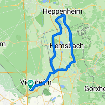
A cycling route starting in Viernheim, Hesse, Germany.
Overview
About this route
118 km from Viernheim through the Ried and back along the Bergstraße to the starting point in Viernheim. Mostly recorded with Teasi GPS. However, it needs to be manually edited because the battery was down in Heppenheim.
- -:--
- Duration
- 116.3 km
- Distance
- 85 m
- Ascent
- 85 m
- Descent
- ---
- Avg. speed
- ---
- Max. altitude
Route quality
Waytypes & surfaces along the route
Waytypes
Road
24.4 km
(21 %)
Quiet road
24.4 km
(21 %)
Surfaces
Paved
102.3 km
(88 %)
Unpaved
3.5 km
(3 %)
Asphalt
90.7 km
(78 %)
Concrete
8.1 km
(7 %)
Continue with Bikemap
Use, edit, or download this cycling route
You would like to ride Ried Manfred or customize it for your own trip? Here is what you can do with this Bikemap route:
Free features
- Save this route as favorite or in collections
- Copy & plan your own version of this route
- Split it into stages to create a multi-day tour
- Sync your route with Garmin or Wahoo
Premium features
Free trial for 3 days, or one-time payment. More about Bikemap Premium.
- Navigate this route on iOS & Android
- Export a GPX / KML file of this route
- Create your custom printout (try it for free)
- Download this route for offline navigation
Discover more Premium features.
Get Bikemap PremiumFrom our community
Other popular routes starting in Viernheim
Sabrinas Horror Strecke 😂- Distance
- 19.3 km
- Ascent
- 19 m
- Descent
- 12 m
- Location
- Viernheim, Hesse, Germany
Viernheim - Ried - Bergstraße - Viernheim (optimiert)- Distance
- 106.4 km
- Ascent
- 73 m
- Descent
- 75 m
- Location
- Viernheim, Hesse, Germany
Ried Manfred- Distance
- 116.3 km
- Ascent
- 85 m
- Descent
- 85 m
- Location
- Viernheim, Hesse, Germany
Saarlandstraße 12-14, Viernheim nach Am Schäferstock 1, Mannheim- Distance
- 10.6 km
- Ascent
- 47 m
- Descent
- 99 m
- Location
- Viernheim, Hesse, Germany
Heddesheim-Ladenburg-Dossenheim-Weinheim- Distance
- 39.1 km
- Ascent
- 76 m
- Descent
- 76 m
- Location
- Viernheim, Hesse, Germany
15 08 05_Rundtour Lindenfels-Bensheim.gpx- Distance
- 79.2 km
- Ascent
- 520 m
- Descent
- 520 m
- Location
- Viernheim, Hesse, Germany
Viernheim-München_empfohlen von Teasi- Distance
- 383.7 km
- Ascent
- 1,151 m
- Descent
- 703 m
- Location
- Viernheim, Hesse, Germany
4nheimer Tour - E-Biker- Distance
- 46.8 km
- Ascent
- 16 m
- Descent
- 16 m
- Location
- Viernheim, Hesse, Germany
Open it in the app


