

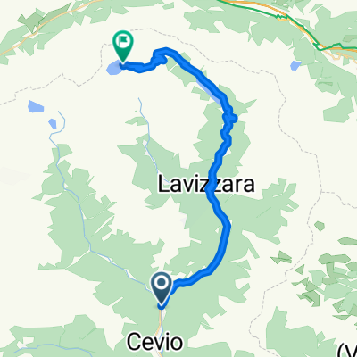
Lago di Naret
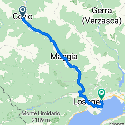
A cycling route starting in Cevio, Canton Ticino, Switzerland.
Overview
About this route
More details here
One of the greatest climbs I have ever done in the Alps. As good or better than most of the famous stuff. 32 kms long, always beautiful. Several stunning lakes along the route and at the summit. Very challenging. The top ... is beautiful. Blog post and photos here- -:--
- Duration
- 67.1 km
- Distance
- 1,941 m
- Ascent
- 1,941 m
- Descent
- ---
- Avg. speed
- ---
- Max. altitude

Route highlights
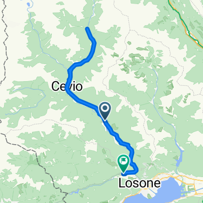
Points of interest along the route
Point of interest after 33 km
Lago di Naret
Continue with Bikemap
Use, edit, or download this cycling route
You would like to ride Lago di Naret or customize it for your own trip? Here is what you can do with this Bikemap route:
Free features
- Save this route as favorite or in collections
- Copy & plan your own version of this route
- Sync your route with Garmin or Wahoo
Premium features
Free trial for 3 days, or one-time payment. More about Bikemap Premium.
- Navigate this route on iOS & Android
- Export a GPX / KML file of this route
- Create your custom printout (try it for free)
- Download this route for offline navigation
Discover more Premium features.
Get Bikemap PremiumFrom our community
Other popular routes starting in Cevio
 Percorso Valle Maggia - Tappa 2
- Distance
- 30.5 km
- Ascent
- 185 m
- Descent
- 402 m
- Location
- Cevio, Canton Ticino, Switzerland
 Valle Bavona und Valle Maggia
- Distance
- 57.1 km
- Ascent
- 113 m
- Descent
- 858 m
- Location
- Cevio, Canton Ticino, Switzerland
 Cevio - Verscio
- Distance
- 60.6 km
- Ascent
- 1,185 m
- Descent
- 1,246 m
- Location
- Cevio, Canton Ticino, Switzerland
 Lago di Naret
- Distance
- 67.1 km
- Ascent
- 1,941 m
- Descent
- 1,941 m
- Location
- Cevio, Canton Ticino, Switzerland
 Laghi del Naret (cronoscalata)
- Distance
- 32 km
- Ascent
- 1,874 m
- Descent
- 0 m
- Location
- Cevio, Canton Ticino, Switzerland
 Laghi del Naret (cronoscalata)
- Distance
- 32 km
- Ascent
- 1,925 m
- Descent
- 46 m
- Location
- Cevio, Canton Ticino, Switzerland
 106Bedrett
- Distance
- 106.4 km
- Ascent
- 1,343 m
- Descent
- 230 m
- Location
- Cevio, Canton Ticino, Switzerland
 locarnonach Via Marcacci
- Distance
- 25.1 km
- Ascent
- 147 m
- Descent
- 317 m
- Location
- Cevio, Canton Ticino, Switzerland
Open it in the app