C1 Histoire et colombages.
- 84.3 km
- 621 m
- 621 m
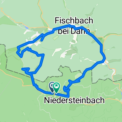
- Lembach, Grand Est, France
A cycling route starting in Lembach, Grand Est, France.
Overview
Niedersteinbach – Niederbronn-les-Bains – Lembach - Niedersteinbach
The route passes through the villages along small shaded roads to reach Niederbronn-les-Bains, Reichshoffen, and then crosses the battlefields of Froeschwiller and Woerth. The 2nd part of the route accesses the villages of the Outre-Forêt to return to the Steinbach valley by passing through Lembach.created this 11 years ago
Route quality
Road
38.8 km
46 %
Quiet road
3.4 km
4 %
Paved
69.1 km
(82 %)
Asphalt
69.1 km
82 %
Undefined
15.2 km
18 %
Continue with Bikemap
You would like to ride C1 Histoire et colombages. or customize it for your own trip? Here is what you can do with this Bikemap route:
Free trial for 3 days, or one-time payment. More about Bikemap Premium.
Discover more Premium features.
Get Bikemap PremiumFrom our community
Open it in the app