

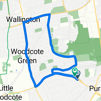
Kenley - Lingfield - kenley
A cycling route starting in Purley, England, United Kingdom.
Overview
About this route
Kenley - Purley - Coulsdon - Bletchingley - Lingfield (Red Barn) - Oxted - Woldingham - Kenley Aerodrome - Kenley
- -:--
- Duration
- 54.4 km
- Distance
- 564 m
- Ascent
- 564 m
- Descent
- ---
- Avg. speed
- ---
- Max. altitude
Route quality
Waytypes & surfaces along the route
Waytypes
Road
30.5 km
(56 %)
Quiet road
13.1 km
(24 %)
Surfaces
Paved
34.8 km
(64 %)
Asphalt
34.8 km
(64 %)
Undefined
19.6 km
(36 %)
Continue with Bikemap
Use, edit, or download this cycling route
You would like to ride Kenley - Lingfield - kenley or customize it for your own trip? Here is what you can do with this Bikemap route:
Free features
- Save this route as favorite or in collections
- Copy & plan your own version of this route
- Sync your route with Garmin or Wahoo
Premium features
Free trial for 3 days, or one-time payment. More about Bikemap Premium.
- Navigate this route on iOS & Android
- Export a GPX / KML file of this route
- Create your custom printout (try it for free)
- Download this route for offline navigation
Discover more Premium features.
Get Bikemap PremiumFrom our community
Other popular routes starting in Purley
 commute to work
- Distance
- 29.5 km
- Ascent
- 205 m
- Descent
- 250 m
- Location
- Purley, England, United Kingdom
 Rendezvous cafe
- Distance
- 23.2 km
- Ascent
- 226 m
- Descent
- 226 m
- Location
- Purley, England, United Kingdom
 Woldingham loop
- Distance
- 25.1 km
- Ascent
- 257 m
- Descent
- 308 m
- Location
- Purley, England, United Kingdom
 Restful route in Purley
- Distance
- 8.1 km
- Ascent
- 79 m
- Descent
- 73 m
- Location
- Purley, England, United Kingdom
 Watney Close 80 to Tilburstow Hill Road
- Distance
- 15.6 km
- Ascent
- 0 m
- Descent
- 8 m
- Location
- Purley, England, United Kingdom
 Chalk Pit Lane Ride
- Distance
- 49.1 km
- Ascent
- 533 m
- Descent
- 531 m
- Location
- Purley, England, United Kingdom
 betchworth and return
- Distance
- 39.8 km
- Ascent
- 1,442 m
- Descent
- 1,440 m
- Location
- Purley, England, United Kingdom
 Kenley - Lingfield - kenley
- Distance
- 54.4 km
- Ascent
- 564 m
- Descent
- 564 m
- Location
- Purley, England, United Kingdom
Open it in the app