

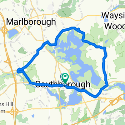
Peach Hill Loop
A cycling route starting in Southborough, Massachusetts, United States.
Overview
About this route
Hilly Loop
- -:--
- Duration
- 44.9 km
- Distance
- 365 m
- Ascent
- 358 m
- Descent
- ---
- Avg. speed
- ---
- Max. altitude
Route quality
Waytypes & surfaces along the route
Waytypes
Road
17.5 km
(39 %)
Quiet road
17.1 km
(38 %)
Surfaces
Paved
21.6 km
(48 %)
Asphalt
21.1 km
(47 %)
Paved (undefined)
0.4 km
(1 %)
Undefined
23.4 km
(52 %)
Continue with Bikemap
Use, edit, or download this cycling route
You would like to ride Peach Hill Loop or customize it for your own trip? Here is what you can do with this Bikemap route:
Free features
- Save this route as favorite or in collections
- Copy & plan your own version of this route
- Sync your route with Garmin or Wahoo
Premium features
Free trial for 3 days, or one-time payment. More about Bikemap Premium.
- Navigate this route on iOS & Android
- Export a GPX / KML file of this route
- Create your custom printout (try it for free)
- Download this route for offline navigation
Discover more Premium features.
Get Bikemap PremiumFrom our community
Other popular routes starting in Southborough
 Peach Hill Loop
- Distance
- 44.9 km
- Ascent
- 365 m
- Descent
- 358 m
- Location
- Southborough, Massachusetts, United States
 chestnut trombetta eastly loop
- Distance
- 20.1 km
- Ascent
- 176 m
- Descent
- 177 m
- Location
- Southborough, Massachusetts, United States
 400 Staples Dr, Framingham to 7 Essex St, Newburyport
- Distance
- 109.3 km
- Ascent
- 1,062 m
- Descent
- 1,143 m
- Location
- Southborough, Massachusetts, United States
 bagel loop
- Distance
- 18.1 km
- Ascent
- 150 m
- Descent
- 151 m
- Location
- Southborough, Massachusetts, United States
 portuguese bakery loop
- Distance
- 28.7 km
- Ascent
- 126 m
- Descent
- 141 m
- Location
- Southborough, Massachusetts, United States
 66 Main St, Southborough to Village Path, Southborough
- Distance
- 12.3 km
- Ascent
- 106 m
- Descent
- 105 m
- Location
- Southborough, Massachusetts, United States
 Relaxed route in Southborough
- Distance
- 5.2 km
- Ascent
- 146 m
- Descent
- 158 m
- Location
- Southborough, Massachusetts, United States
 Around Whitehall
- Distance
- 40 km
- Ascent
- 296 m
- Descent
- 297 m
- Location
- Southborough, Massachusetts, United States
Open it in the app