Bukowsko - Tokarnia - Jasiel
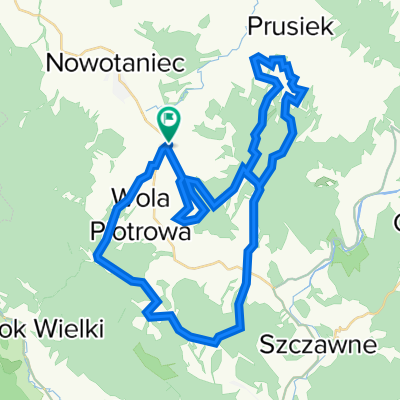
A cycling route starting in Bukowsko, Subcarpathian Voivodeship, Poland.
Overview
About this route
Bukowsko - Tokarnia (778) - Smokowiska - Moszczaniec - Jasiel - Wola Niżna - Polany Surowiczne - Puławy - Pastwiska - Wola Sękowa - Bukowsko
- -:--
- Duration
- 78.7 km
- Distance
- 833 m
- Ascent
- 836 m
- Descent
- ---
- Avg. speed
- ---
- Max. altitude
Route quality
Waytypes & surfaces along the route
Waytypes
Track
33.1 km
(42 %)
Quiet road
12.6 km
(16 %)
Surfaces
Paved
37.8 km
(48 %)
Unpaved
26.8 km
(34 %)
Asphalt
31.5 km
(40 %)
Ground
14.2 km
(18 %)
Continue with Bikemap
Use, edit, or download this cycling route
You would like to ride Bukowsko - Tokarnia - Jasiel or customize it for your own trip? Here is what you can do with this Bikemap route:
Free features
- Save this route as favorite or in collections
- Copy & plan your own version of this route
- Sync your route with Garmin or Wahoo
Premium features
Free trial for 3 days, or one-time payment. More about Bikemap Premium.
- Navigate this route on iOS & Android
- Export a GPX / KML file of this route
- Create your custom printout (try it for free)
- Download this route for offline navigation
Discover more Premium features.
Get Bikemap PremiumFrom our community
Other popular routes starting in Bukowsko
- Tokarnia - Wola Sękowa -Nowotaniec - Tokarnia
- Distance
- 18.5 km
- Ascent
- 221 m
- Descent
- 221 m
- Location
- Bukowsko, Subcarpathian Voivodeship, Poland
- 2018.09.21 Beskid Niski 3/3 Bukowsko- Rzeszów
- Distance
- 107.6 km
- Ascent
- 259 m
- Descent
- 575 m
- Location
- Bukowsko, Subcarpathian Voivodeship, Poland
- karlików
- Distance
- 12.1 km
- Ascent
- 461 m
- Descent
- 464 m
- Location
- Bukowsko, Subcarpathian Voivodeship, Poland
- 2011-04-16 Bieszczady: Chryszczata (998m), Przełęcz Żebrak (816m), Przęłęcz Przysłup (749m), Przełęcz nad Roztokami (801m), Okrąglik (1101), Jasło (1153)
- Distance
- 87.2 km
- Ascent
- 1,432 m
- Descent
- 1,386 m
- Location
- Bukowsko, Subcarpathian Voivodeship, Poland
- Bukowsko Half
- Distance
- 48.1 km
- Ascent
- 1,418 m
- Descent
- 1,416 m
- Location
- Bukowsko, Subcarpathian Voivodeship, Poland
- Tokarnia - TOKARNIA (778) - Tokarnia
- Distance
- 12.9 km
- Ascent
- 386 m
- Descent
- 386 m
- Location
- Bukowsko, Subcarpathian Voivodeship, Poland
- Pogórze Bukowskie
- Distance
- 22.2 km
- Ascent
- 183 m
- Descent
- 182 m
- Location
- Bukowsko, Subcarpathian Voivodeship, Poland
- Polańska, Wahlowski W, Rzepedka
- Distance
- 76 km
- Ascent
- 1,138 m
- Descent
- 1,137 m
- Location
- Bukowsko, Subcarpathian Voivodeship, Poland
Open it in the app