

Aischtalradweg von Forchheim zu Holdermühle
A cycling route starting in Adelshofen, Bavaria, Germany.
Overview
About this route
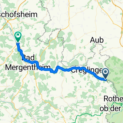
from Forchheim train station to Holdermühle
- -:--
- Duration
- 105.4 km
- Distance
- 252 m
- Ascent
- 279 m
- Descent
- ---
- Avg. speed
- ---
- Max. altitude
Route quality
Waytypes & surfaces along the route
Waytypes
Track
46.4 km
(44 %)
Quiet road
25.3 km
(24 %)
Surfaces
Paved
74.8 km
(71 %)
Unpaved
9.5 km
(9 %)
Asphalt
55.9 km
(53 %)
Paved (undefined)
11.6 km
(11 %)
Continue with Bikemap
Use, edit, or download this cycling route
You would like to ride Aischtalradweg von Forchheim zu Holdermühle or customize it for your own trip? Here is what you can do with this Bikemap route:
Free features
- Save this route as favorite or in collections
- Copy & plan your own version of this route
- Split it into stages to create a multi-day tour
- Sync your route with Garmin or Wahoo
Premium features
Free trial for 3 days, or one-time payment. More about Bikemap Premium.
- Navigate this route on iOS & Android
- Export a GPX / KML file of this route
- Create your custom printout (try it for free)
- Download this route for offline navigation
Discover more Premium features.
Get Bikemap PremiumFrom our community
Other popular routes starting in Adelshofen
 rothenb-heim
- Distance
- 60.8 km
- Ascent
- 303 m
- Descent
- 299 m
- Location
- Adelshofen, Bavaria, Germany
 Feierabendrunde
- Distance
- 45.5 km
- Ascent
- 287 m
- Descent
- 287 m
- Location
- Adelshofen, Bavaria, Germany
 2010 Holdermühle-Steinbachtal
- Distance
- 23.8 km
- Ascent
- 196 m
- Descent
- 194 m
- Location
- Adelshofen, Bavaria, Germany
 2021/07/22 - 4 Tage durch Westfranken - 4. Tag
- Distance
- 63.6 km
- Ascent
- 258 m
- Descent
- 107 m
- Location
- Adelshofen, Bavaria, Germany
 Vechelde - München 5. Etappe
- Distance
- 100.8 km
- Ascent
- 340 m
- Descent
- 238 m
- Location
- Adelshofen, Bavaria, Germany
 Radltour2015_Etappe3
- Distance
- 38.4 km
- Ascent
- 279 m
- Descent
- 383 m
- Location
- Adelshofen, Bavaria, Germany
 2017 Holdermühle/Tauber--Gern/Altmühl
- Distance
- 70.6 km
- Ascent
- 312 m
- Descent
- 190 m
- Location
- Adelshofen, Bavaria, Germany
 2010-Tag14: Holdermühle-Steinbachtal und zurück
- Distance
- 23.5 km
- Ascent
- 172 m
- Descent
- 169 m
- Location
- Adelshofen, Bavaria, Germany
Open it in the app