

Haut Koenigsbourg (Vogesen)
A cycling route starting in Gottenheim, Baden-Wurttemberg, Germany.
Overview
About this route
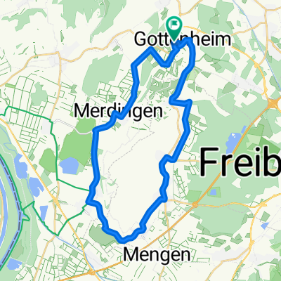
Day tour from Kaiserstuhl to the Hoch Königsburg castle near Sélestat in the Vosges. Start and finish in Gottenheim at Kaiserstuhl. Initially on the L114 towards Breisach. Via Neuf-Brisach, Biesheim, Urschenheim to Houssen. Continuing along the Alsace Wine Route to Riquewihr and Bergheim. On the D42 through Thannenkirch to the Hoch Königsburg (757 m above sea level). Descent via the D159 to Kintzheim, then to Scherwiller. Through the Upper Rhine Plain to Ebersheim, Muttersholtz, Artolsheim and Marckolsheim to Sasbach. Returning to Gottenheim via Endingen and Riegel.
- -:--
- Duration
- 142.2 km
- Distance
- 619 m
- Ascent
- 623 m
- Descent
- ---
- Avg. speed
- ---
- Max. altitude

Continue with Bikemap
Use, edit, or download this cycling route
You would like to ride Haut Koenigsbourg (Vogesen) or customize it for your own trip? Here is what you can do with this Bikemap route:
Free features
- Save this route as favorite or in collections
- Copy & plan your own version of this route
- Split it into stages to create a multi-day tour
- Sync your route with Garmin or Wahoo
Premium features
Free trial for 3 days, or one-time payment. More about Bikemap Premium.
- Navigate this route on iOS & Android
- Export a GPX / KML file of this route
- Create your custom printout (try it for free)
- Download this route for offline navigation
Discover more Premium features.
Get Bikemap PremiumFrom our community
Other popular routes starting in Gottenheim
 gundelfingen denzlingen emmendingen teningen eichstetten bötzingen gottenheim
- Distance
- 44.8 km
- Ascent
- 84 m
- Descent
- 86 m
- Location
- Gottenheim, Baden-Wurttemberg, Germany
 Kaiserstuhl-Runde
- Distance
- 60.1 km
- Ascent
- 0 m
- Descent
- 0 m
- Location
- Gottenheim, Baden-Wurttemberg, Germany
 Kaiserstuhl-Radweg
- Distance
- 72.7 km
- Ascent
- 351 m
- Descent
- 274 m
- Location
- Gottenheim, Baden-Wurttemberg, Germany
 Kaiserstuhlrunde
- Distance
- 40.7 km
- Ascent
- 719 m
- Descent
- 719 m
- Location
- Gottenheim, Baden-Wurttemberg, Germany
 Kaiserstuhl
- Distance
- 49.8 km
- Ascent
- 190 m
- Descent
- 190 m
- Location
- Gottenheim, Baden-Wurttemberg, Germany
 Um den Tuniberg
- Distance
- 28.2 km
- Ascent
- 96 m
- Descent
- 93 m
- Location
- Gottenheim, Baden-Wurttemberg, Germany
 Runde 1 am Kaiserstuhl
- Distance
- 30.9 km
- Ascent
- 726 m
- Descent
- 718 m
- Location
- Gottenheim, Baden-Wurttemberg, Germany
 March-Reute-Teningen-Riegel-Bötzingen
- Distance
- 42.5 km
- Ascent
- 74 m
- Descent
- 77 m
- Location
- Gottenheim, Baden-Wurttemberg, Germany
Open it in the app