

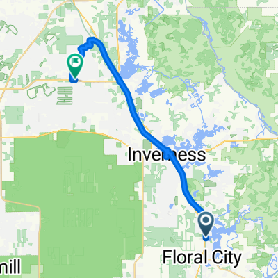
SunShine Valley
A cycling route starting in Floral City, Florida, United States.
Overview
About this route
This route is beautifl. If you have a racing bike or mountain bike this trail is great for you. It also is great for people on their way to work. This trail passes by an airport and will get you exactly where you wanna be.
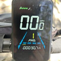
- -:--
- Duration
- 61.8 km
- Distance
- 136 m
- Ascent
- 126 m
- Descent
- ---
- Avg. speed
- ---
- Max. altitude
Continue with Bikemap
Use, edit, or download this cycling route
You would like to ride SunShine Valley or customize it for your own trip? Here is what you can do with this Bikemap route:
Free features
- Save this route as favorite or in collections
- Copy & plan your own version of this route
- Sync your route with Garmin or Wahoo
Premium features
Free trial for 3 days, or one-time payment. More about Bikemap Premium.
- Navigate this route on iOS & Android
- Export a GPX / KML file of this route
- Create your custom printout (try it for free)
- Download this route for offline navigation
Discover more Premium features.
Get Bikemap PremiumFrom our community
Other popular routes starting in Floral City
 E Orange Ave, Floral City to Croom Rital Rd, Brooksville
- Distance
- 20 km
- Ascent
- 70 m
- Descent
- 72 m
- Location
- Floral City, Florida, United States
 SunShine Valley
- Distance
- 61.8 km
- Ascent
- 136 m
- Descent
- 126 m
- Location
- Floral City, Florida, United States
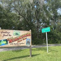
 Withlacoochee State Trail, Floral City to Withlacoochee State Trail, Floral City
- Distance
- 1.7 km
- Ascent
- 15 m
- Descent
- 19 m
- Location
- Floral City, Florida, United States
 E Levy Ct, Floral City to S Bridges Rd, Dunnellon
- Distance
- 42.9 km
- Ascent
- 144 m
- Descent
- 149 m
- Location
- Floral City, Florida, United States
 E Kabrich Ln, Floral City to N Trucks Ave, Hernando
- Distance
- 30.3 km
- Ascent
- 61 m
- Descent
- 60 m
- Location
- Floral City, Florida, United States
 Recovered Route
- Distance
- 57.7 km
- Ascent
- 165 m
- Descent
- 172 m
- Location
- Floral City, Florida, United States
 Withlacoochee State Trail, Floral City to Withlacoochee State Trail, Brooksville
- Distance
- 19.9 km
- Ascent
- 104 m
- Descent
- 103 m
- Location
- Floral City, Florida, United States
 Withlacoochee State Trail, Floral City to Withlacoochee State Trail, Brooksville
- Distance
- 20.2 km
- Ascent
- 146 m
- Descent
- 148 m
- Location
- Floral City, Florida, United States
Open it in the app