

petitballon platzerwasel
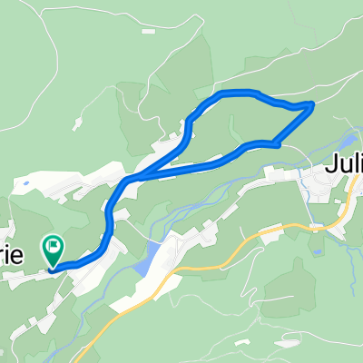
A cycling route starting in Saint-Amé, Grand Est, France.
Overview
About this route
sur les trace du tour de france 2014
- -:--
- Duration
- 131.6 km
- Distance
- 2,507 m
- Ascent
- 2,507 m
- Descent
- ---
- Avg. speed
- ---
- Max. altitude
Route quality
Waytypes & surfaces along the route
Waytypes
Busy road
60.5 km
(46 %)
Road
33.4 km
(25 %)
Surfaces
Paved
90.6 km
(69 %)
Unpaved
6.7 km
(5 %)
Asphalt
90.5 km
(69 %)
Ground
3.3 km
(3 %)
Continue with Bikemap
Use, edit, or download this cycling route
You would like to ride petitballon platzerwasel or customize it for your own trip? Here is what you can do with this Bikemap route:
Free features
- Save this route as favorite or in collections
- Copy & plan your own version of this route
- Split it into stages to create a multi-day tour
- Sync your route with Garmin or Wahoo
Premium features
Free trial for 3 days, or one-time payment. More about Bikemap Premium.
- Navigate this route on iOS & Android
- Export a GPX / KML file of this route
- Create your custom printout (try it for free)
- Download this route for offline navigation
Discover more Premium features.
Get Bikemap PremiumFrom our community
Other popular routes starting in Saint-Amé
 cleurie la forge rain brice liezey les xettes col de sapois vagney
- Distance
- 48 km
- Ascent
- 833 m
- Descent
- 834 m
- Location
- Saint-Amé, Grand Est, France
 saint amé la colline belfahly planche des belles filles ballon de servance col de morbieux st amé
- Distance
- 119.5 km
- Ascent
- 2,191 m
- Descent
- 2,189 m
- Location
- Saint-Amé, Grand Est, France
 De 11 Route de Purifaing, Cleurie à Voie Verte, Saulxures-sur-Moselotte
- Distance
- 15.3 km
- Ascent
- 204 m
- Descent
- 329 m
- Location
- Saint-Amé, Grand Est, France
 st amé croix des moinats lispach xonrupt col de sapois st amé
- Distance
- 64.9 km
- Ascent
- 1,022 m
- Descent
- 1,021 m
- Location
- Saint-Amé, Grand Est, France
 st ame raon arches rehaupal tholy col de sapois
- Distance
- 83.3 km
- Ascent
- 856 m
- Descent
- 856 m
- Location
- Saint-Amé, Grand Est, France
 les trois cols moinats grossepierre sapois
- Distance
- 51 km
- Ascent
- 965 m
- Descent
- 967 m
- Location
- Saint-Amé, Grand Est, France
 cleurie la forge le tholy rain brice liezey les xettes sapois vagney
- Distance
- 47.7 km
- Ascent
- 829 m
- Descent
- 829 m
- Location
- Saint-Amé, Grand Est, France
 De Route de Xhoris 10 Bis, Cleurie à Route de Xhoris 10, Cleurie
- Distance
- 4.5 km
- Ascent
- 105 m
- Descent
- 106 m
- Location
- Saint-Amé, Grand Est, France
Open it in the app