


25/09/23
- 52.1 km
- 1,198 m
- 1,196 m
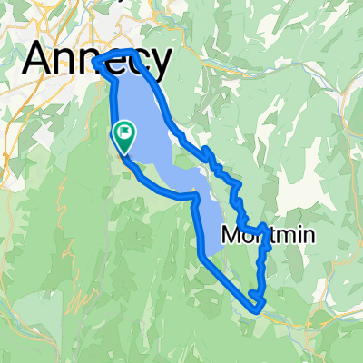
- Sevrier, Auvergne-Rhône-Alpes, France
A cycling route starting in Sevrier, Auvergne-Rhône-Alpes, France.
Overview
Lake 1 with Col de Leschaux, Col de Pres, and Col de Plainpalais
created this 11 years ago
Route quality
Road
20.8 km
(22 %)
Quiet road
1.9 km
(2 %)
Undefined
71.8 km
(76 %)
Paved
84 km
(89 %)
Asphalt
84 km
(89 %)
Undefined
10.4 km
(11 %)
Continue with Bikemap
You would like to ride Annecy 1 or customize it for your own trip? Here is what you can do with this Bikemap route:
Free trial for 3 days, or one-time payment. More about Bikemap Premium.
Discover more Premium features.
Get Bikemap PremiumFrom our community
Open it in the app


