

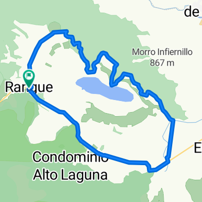
El Paico - Rinconada - El Paico
A cycling route starting in El Monte, Santiago Metropolitan, Chile.
Overview
About this route
Route from El Paico in El Monte to Camino to Rinconada in Maipú, round trip.
- -:--
- Duration
- 93 km
- Distance
- 299 m
- Ascent
- 298 m
- Descent
- ---
- Avg. speed
- ---
- Max. altitude
Continue with Bikemap
Use, edit, or download this cycling route
You would like to ride El Paico - Rinconada - El Paico or customize it for your own trip? Here is what you can do with this Bikemap route:
Free features
- Save this route as favorite or in collections
- Copy & plan your own version of this route
- Split it into stages to create a multi-day tour
- Sync your route with Garmin or Wahoo
Premium features
Free trial for 3 days, or one-time payment. More about Bikemap Premium.
- Navigate this route on iOS & Android
- Export a GPX / KML file of this route
- Create your custom printout (try it for free)
- Download this route for offline navigation
Discover more Premium features.
Get Bikemap PremiumFrom our community
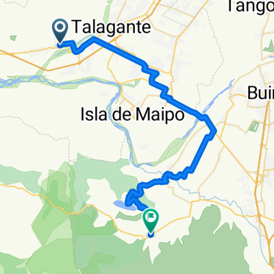
Other popular routes starting in El Monte
 Laguna de Aculeo
- Distance
- 24.7 km
- Ascent
- 223 m
- Descent
- 228 m
- Location
- El Monte, Santiago Metropolitan, Chile
 El Paico - Minas de Naltahua
- Distance
- 47.7 km
- Ascent
- 171 m
- Descent
- 155 m
- Location
- El Monte, Santiago Metropolitan, Chile
 De Uno Poniente 1259, Talagante a Uno Poniente 1271, Talagante
- Distance
- 18.2 km
- Ascent
- 63 m
- Descent
- 65 m
- Location
- El Monte, Santiago Metropolitan, Chile
 El Monte - melipilla - Cholqui - L.Aculeo - V.de Paine - I. Maipo - Talagante - El Monte
- Distance
- 117 km
- Ascent
- 548 m
- Descent
- 548 m
- Location
- El Monte, Santiago Metropolitan, Chile
 De Uno Poniente 1267, Talagante a Uno Poniente 1269, Talagante
- Distance
- 19.3 km
- Ascent
- 68 m
- Descent
- 69 m
- Location
- El Monte, Santiago Metropolitan, Chile
 El Paico - Rinconada - El Paico
- Distance
- 93 km
- Ascent
- 299 m
- Descent
- 298 m
- Location
- El Monte, Santiago Metropolitan, Chile
 Paseo lento en El Monte
- Distance
- 5.8 km
- Ascent
- 22 m
- Descent
- 19 m
- Location
- El Monte, Santiago Metropolitan, Chile
 De El Monte a Paine
- Distance
- 50.7 km
- Ascent
- 736 m
- Descent
- 658 m
- Location
- El Monte, Santiago Metropolitan, Chile
Open it in the app