

Dresden-Freiberg mal anders
A cycling route starting in Dresden, Saxony, Germany.
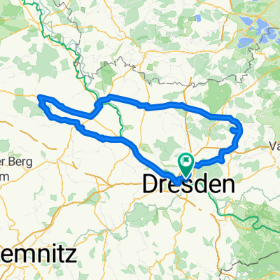
Overview
About this route
Da ich ursprünglich aus FG komme wollte ich mal nach FG fahren - mit dem Fahrrad. Und da mir über Hartha zu schwer vorkam, dachte ich mal entlang der A4... Aber auch diese Strecke ist nicht von schlechten Eltern :)
Gerade aus Dresden rau
- -:--
- Duration
- 42.4 km
- Distance
- 582 m
- Ascent
- 346 m
- Descent
- ---
- Avg. speed
- 362 m
- Max. altitude
Route quality
Waytypes & surfaces along the route
Waytypes
Quiet road
15.7 km
(37 %)
Road
6.4 km
(15 %)
Surfaces
Paved
26.3 km
(62 %)
Unpaved
3 km
(7 %)
Asphalt
26.3 km
(62 %)
Gravel
3 km
(7 %)
Undefined
13.1 km
(31 %)
Continue with Bikemap
Use, edit, or download this cycling route
You would like to ride Dresden-Freiberg mal anders or customize it for your own trip? Here is what you can do with this Bikemap route:
Free features
- Save this route as favorite or in collections
- Copy & plan your own version of this route
- Sync your route with Garmin or Wahoo
Premium features
Free trial for 3 days, or one-time payment. More about Bikemap Premium.
- Navigate this route on iOS & Android
- Export a GPX / KML file of this route
- Create your custom printout (try it for free)
- Download this route for offline navigation
Discover more Premium features.
Get Bikemap PremiumFrom our community
Other popular routes starting in Dresden
 Pre Velorace Trainingsausfahrt 2015 Einsteiger
- Distance
- 44.6 km
- Ascent
- 222 m
- Descent
- 222 m
- Location
- Dresden, Saxony, Germany
 Schmorsdorfer Höhenrunde
- Distance
- 49.8 km
- Ascent
- 510 m
- Descent
- 488 m
- Location
- Dresden, Saxony, Germany
 Dresden - Altenberg
- Distance
- 52.7 km
- Ascent
- 1,016 m
- Descent
- 385 m
- Location
- Dresden, Saxony, Germany
 Dresden - Glashütte - Bahratal
- Distance
- 90.4 km
- Ascent
- 1,112 m
- Descent
- 1,142 m
- Location
- Dresden, Saxony, Germany
 DD-Collm-Riesa-Keulenberg-DD
- Distance
- 196.8 km
- Ascent
- 1,000 m
- Descent
- 904 m
- Location
- Dresden, Saxony, Germany
 Ponickau
- Distance
- 122.5 km
- Ascent
- 320 m
- Descent
- 323 m
- Location
- Dresden, Saxony, Germany
 Müglitztal - Königstein - Breitenau
- Distance
- 156 km
- Ascent
- 2,539 m
- Descent
- 2,398 m
- Location
- Dresden, Saxony, Germany
 Rennradrunde um den Tharandter Wald
- Distance
- 78.9 km
- Ascent
- 934 m
- Descent
- 850 m
- Location
- Dresden, Saxony, Germany
Open it in the app