

Vigiljoch
A cycling route starting in Rablà, Trentino-Alto Adige, Italy.
Overview
About this route
s
- -:--
- Duration
- 24.5 km
- Distance
- 1,409 m
- Ascent
- 1,409 m
- Descent
- ---
- Avg. speed
- ---
- Max. altitude
Continue with Bikemap
Use, edit, or download this cycling route
You would like to ride Vigiljoch or customize it for your own trip? Here is what you can do with this Bikemap route:
Free features
- Save this route as favorite or in collections
- Copy & plan your own version of this route
- Sync your route with Garmin or Wahoo
Premium features
Free trial for 3 days, or one-time payment. More about Bikemap Premium.
- Navigate this route on iOS & Android
- Export a GPX / KML file of this route
- Create your custom printout (try it for free)
- Download this route for offline navigation
Discover more Premium features.
Get Bikemap PremiumFrom our community
Other popular routes starting in Rablà
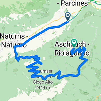 22 Naturnseralm-Vigiljoch
- Distance
- 29.6 km
- Ascent
- 2,030 m
- Descent
- 1,239 m
- Location
- Rablà, Trentino-Alto Adige, Italy
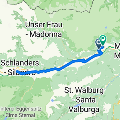 46.676, 11.060 nach 46.682, 11.072
- Distance
- 57.8 km
- Ascent
- 385 m
- Descent
- 320 m
- Location
- Rablà, Trentino-Alto Adige, Italy
 Vigiljoch
- Distance
- 24.5 km
- Ascent
- 1,409 m
- Descent
- 1,409 m
- Location
- Rablà, Trentino-Alto Adige, Italy
 Vigiljoch2
- Distance
- 22.1 km
- Ascent
- 1,354 m
- Descent
- 1,358 m
- Location
- Rablà, Trentino-Alto Adige, Italy
 Trans Alp 2013 - Psycho Cross - Etappe 5
- Distance
- 49.6 km
- Ascent
- 3,122 m
- Descent
- 2,166 m
- Location
- Rablà, Trentino-Alto Adige, Italy
 2 Meraner Höhenweg
- Distance
- 13.5 km
- Ascent
- 412 m
- Descent
- 756 m
- Location
- Rablà, Trentino-Alto Adige, Italy
 Von Rabland nach Ötztal (über das Timmelsjoch)
- Distance
- 121.4 km
- Ascent
- 2,296 m
- Descent
- 2,110 m
- Location
- Rablà, Trentino-Alto Adige, Italy
 46.646, 11.098 nach 46.682, 11.072
- Distance
- 18 km
- Ascent
- 194 m
- Descent
- 1,300 m
- Location
- Rablà, Trentino-Alto Adige, Italy
Open it in the app