


Ruta nº 64 - Julio 2019
- 79 km
- 310 m
- 309 m
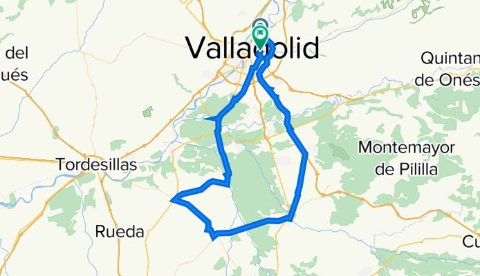
- Valladolid, Castille and León, Spain
A cycling route starting in Valladolid, Castille and León, Spain.
Overview
Ronda (este) - Ctra.Segovia - (a través de vía servicio) - Aldeamayor - La Pedraja - Mojados - Matapozuelos - Serrada - Valdestillas - Pte.Duero - Valladolid
Subida: Picones
Pendiente media no puntúa
created this 11 years ago
Route quality
Road
34.1 km
(40 %)
Cycleway
17 km
(20 %)
Paved
69.9 km
(82 %)
Asphalt
69.9 km
(82 %)
Undefined
15.3 km
(18 %)
Route highlights
Subida: Picones Pendiente media no puntúa
Continue with Bikemap
You would like to ride 2022 - Ruta nº 025 or customize it for your own trip? Here is what you can do with this Bikemap route:
Free trial for 3 days, or one-time payment. More about Bikemap Premium.
Discover more Premium features.
Get Bikemap PremiumFrom our community
Open it in the app


