

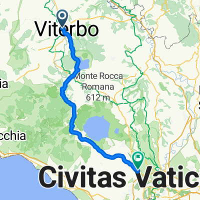
1. Crono VT
A cycling route starting in Viterbo, Lazio, Italy.
Overview
About this route
crono VT
- -:--
- Duration
- 45.1 km
- Distance
- 1,259 m
- Ascent
- 637 m
- Descent
- ---
- Avg. speed
- ---
- Max. altitude

Route quality
Waytypes & surfaces along the route
Waytypes
Road
12.2 km
(27 %)
Quiet road
6.3 km
(14 %)
Undefined
26.6 km
(59 %)
Surfaces
Paved
21.2 km
(47 %)
Asphalt
20.7 km
(46 %)
Concrete
0.5 km
(1 %)
Undefined
23.9 km
(53 %)
Route highlights
Points of interest along the route
Point of interest after 5.7 km
strada romana
Point of interest after 36.6 km
Muro di Canepina
Point of interest after 43.7 km
Monte Cimino
Continue with Bikemap
Use, edit, or download this cycling route
You would like to ride 1. Crono VT or customize it for your own trip? Here is what you can do with this Bikemap route:
Free features
- Save this route as favorite or in collections
- Copy & plan your own version of this route
- Sync your route with Garmin or Wahoo
Premium features
Free trial for 3 days, or one-time payment. More about Bikemap Premium.
- Navigate this route on iOS & Android
- Export a GPX / KML file of this route
- Create your custom printout (try it for free)
- Download this route for offline navigation
Discover more Premium features.
Get Bikemap PremiumFrom our community
Other popular routes starting in Viterbo
 anno04 Viterbo Roma Tor di quinto
- Distance
- 89.4 km
- Ascent
- 800 m
- Descent
- 1,101 m
- Location
- Viterbo, Lazio, Italy
 Viterbo - Orvieto - Todi - Spoleto - Leonessa - Amatrice - Lago di Campotosto - L'Aquila
- Distance
- 283.7 km
- Ascent
- 2,752 m
- Descent
- 2,447 m
- Location
- Viterbo, Lazio, Italy
 RVCC Italy Trip - Day 4 - Viterbo to Rome Outskirts
- Distance
- 76.7 km
- Ascent
- 744 m
- Descent
- 901 m
- Location
- Viterbo, Lazio, Italy
 Herisau Sizilien 6. etappe Orvieto - Rom
- Distance
- 155.9 km
- Ascent
- 766 m
- Descent
- 1,022 m
- Location
- Viterbo, Lazio, Italy
 VIA FRANCIGENA- Viterbo/Città del Vaticano
- Distance
- 84.4 km
- Ascent
- 464 m
- Descent
- 794 m
- Location
- Viterbo, Lazio, Italy
 VIA FRANCIGENA- Viterbo/Città del Vaticano
- Distance
- 84.3 km
- Ascent
- 456 m
- Descent
- 786 m
- Location
- Viterbo, Lazio, Italy
 ZEPPELIN2010_Via Francigena da Viterbo a Roma
- Distance
- 97.1 km
- Ascent
- 577 m
- Descent
- 882 m
- Location
- Viterbo, Lazio, Italy
 1. Crono VT
- Distance
- 45.1 km
- Ascent
- 1,259 m
- Descent
- 637 m
- Location
- Viterbo, Lazio, Italy
Open it in the app