

Ab AB Abfahrt Gröden nach Sarnthein bis Bozen
A cycling route starting in Waidbruck, Trentino-Alto Adige, Italy.
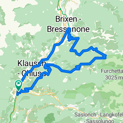
Overview
About this route
to Sarnthein the route of the 5th stage JBT 2009 to Sarnthein. Nice long climb at the start. 1,700 m of elevation later beautiful singletrails. Technically demanding.
- -:--
- Duration
- 66.6 km
- Distance
- 1,983 m
- Ascent
- 2,216 m
- Descent
- ---
- Avg. speed
- ---
- Max. altitude

Continue with Bikemap
Use, edit, or download this cycling route
You would like to ride Ab AB Abfahrt Gröden nach Sarnthein bis Bozen or customize it for your own trip? Here is what you can do with this Bikemap route:
Free features
- Save this route as favorite or in collections
- Copy & plan your own version of this route
- Sync your route with Garmin or Wahoo
Premium features
Free trial for 3 days, or one-time payment. More about Bikemap Premium.
- Navigate this route on iOS & Android
- Export a GPX / KML file of this route
- Create your custom printout (try it for free)
- Download this route for offline navigation
Discover more Premium features.
Get Bikemap PremiumFrom our community
Other popular routes starting in Waidbruck
 Kollmann-Trient
- Distance
- 92.5 km
- Ascent
- 940 m
- Descent
- 1,227 m
- Location
- Waidbruck, Trentino-Alto Adige, Italy
 AA 006: Bergwelt und Eisacktal bei Brixen
- Distance
- 74 km
- Ascent
- 1,896 m
- Descent
- 1,896 m
- Location
- Waidbruck, Trentino-Alto Adige, Italy
 p15 Passo Gardena
- Distance
- 39.8 km
- Ascent
- 1,633 m
- Descent
- 612 m
- Location
- Waidbruck, Trentino-Alto Adige, Italy
 20140406
- Distance
- 29.2 km
- Ascent
- 804 m
- Descent
- 806 m
- Location
- Waidbruck, Trentino-Alto Adige, Italy
 Kleine Runde
- Distance
- 7.9 km
- Ascent
- 386 m
- Descent
- 387 m
- Location
- Waidbruck, Trentino-Alto Adige, Italy
 SeiserAlm-PlattkofelHütte-SellaJoch
- Distance
- 66 km
- Ascent
- 2,028 m
- Descent
- 2,028 m
- Location
- Waidbruck, Trentino-Alto Adige, Italy
 Wolkenstein
- Distance
- 106.8 km
- Ascent
- 3,336 m
- Descent
- 3,476 m
- Location
- Waidbruck, Trentino-Alto Adige, Italy
 flussabwärts, aber mit Gegenwind
- Distance
- 24.1 km
- Ascent
- 419 m
- Descent
- 634 m
- Location
- Waidbruck, Trentino-Alto Adige, Italy
Open it in the app