Generała Romualda Traugutta 88, Wrocław do Generała Romualda Traugutta 90, Wrocław
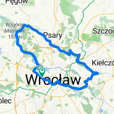
- 41.6 km
- 37 m
- 74 m
- Wroclaw, Lower Silesian Voivodeship, Poland
A cycling route starting in Wroclaw, Lower Silesian Voivodeship, Poland.
Overview
Wrocław (Park Południowy) -> Wysoka -> Ślęza -> Karwiany -> Komorowice -> Szukalice -> Galowice -> Wilczków -> Pełczyce -> Kuklice -> Szczepanowice -> Budziszów -> Tyniec nad Ślężą -> Biskupice -> Wilczkowice -> Nasławice -> Sobótka
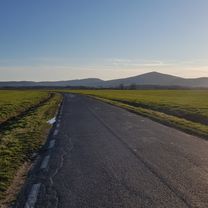
Trasa tak naprawdę ma ok 42 km, wiedzie głownie asfaltem (95%). Ruch praktycznie zerowy.
created this 16 years ago
Route quality
Road
17.3 km
(43 %)
Quiet road
10.9 km
(27 %)
Paved
21.8 km
(54 %)
Unpaved
6.9 km
(17 %)
Asphalt
19.8 km
(49 %)
Ground
4.4 km
(11 %)
Continue with Bikemap
You would like to ride Wrocław - Sobóka (czerwony szlak) or customize it for your own trip? Here is what you can do with this Bikemap route:
Free trial for 3 days, or one-time payment. More about Bikemap Premium.
Discover more Premium features.
Get Bikemap PremiumFrom our community
Open it in the app