

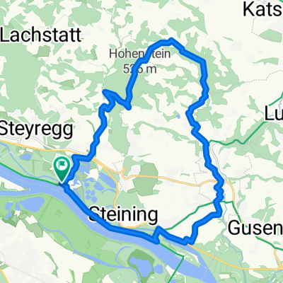
Solar City - Langenstein
A cycling route starting in Steyregg, Upper Austria, Austria.
Overview
About this route
- -:--
- Duration
- 15.1 km
- Distance
- 29 m
- Ascent
- 36 m
- Descent
- ---
- Avg. speed
- 257 m
- Avg. speed
Route quality
Waytypes & surfaces along the route
Waytypes
Cycleway
5.4 km
(36 %)
Path
4 km
(27 %)
Surfaces
Paved
14 km
(93 %)
Unpaved
0.8 km
(5 %)
Asphalt
14 km
(93 %)
Loose gravel
0.6 km
(4 %)
Continue with Bikemap
Use, edit, or download this cycling route
You would like to ride Solar City - Langenstein or customize it for your own trip? Here is what you can do with this Bikemap route:
Free features
- Save this route as favorite or in collections
- Copy & plan your own version of this route
- Sync your route with Garmin or Wahoo
Premium features
Free trial for 3 days, or one-time payment. More about Bikemap Premium.
- Navigate this route on iOS & Android
- Export a GPX / KML file of this route
- Create your custom printout (try it for free)
- Download this route for offline navigation
Discover more Premium features.
Get Bikemap PremiumFrom our community
Other popular routes starting in Steyregg
 Südlicher Pfenningberg
- Distance
- 8.9 km
- Ascent
- 416 m
- Descent
- 300 m
- Location
- Steyregg, Upper Austria, Austria
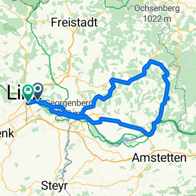
 Hohenstein
- Distance
- 21.5 km
- Ascent
- 306 m
- Descent
- 308 m
- Location
- Steyregg, Upper Austria, Austria
 MTB Runde 55km - Satzing - Pürach - Götzelsdorf - Holzwinden - Lachstadt - Pfenningberg - Plesching - Linz-Urfahr - Lichtenberg - GIS Warte - Lichtenberg - Linz
- Distance
- 55.7 km
- Ascent
- 1,295 m
- Descent
- 1,297 m
- Location
- Steyregg, Upper Austria, Austria
 Nette Abendrunde
- Distance
- 39.2 km
- Ascent
- 472 m
- Descent
- 465 m
- Location
- Steyregg, Upper Austria, Austria
 20190111 Spaziergang mit Krone
- Distance
- 10.3 km
- Ascent
- 282 m
- Descent
- 281 m
- Location
- Steyregg, Upper Austria, Austria
 Linz-Gramastetten-Kirchaschlag-Goli-Linz
- Distance
- 70.8 km
- Ascent
- 1,424 m
- Descent
- 1,424 m
- Location
- Steyregg, Upper Austria, Austria
 Linz-Königswiesen-Grein-Linz
- Distance
- 151.6 km
- Ascent
- 935 m
- Descent
- 923 m
- Location
- Steyregg, Upper Austria, Austria
 erste Etappe Ly und jo
- Distance
- 75.9 km
- Ascent
- 386 m
- Descent
- 136 m
- Location
- Steyregg, Upper Austria, Austria
Open it in the app