Haardt - Weinbiet - Haßloch
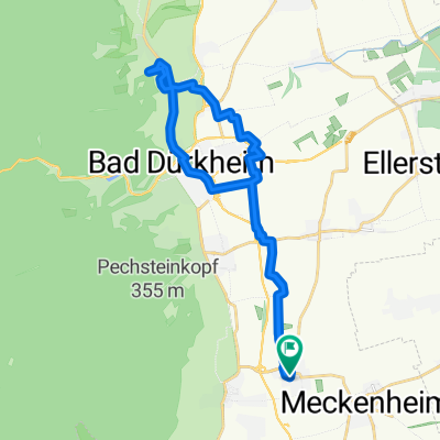
A cycling route starting in Niederkirchen bei Deidesheim, Rhineland-Palatinate, Germany.
Overview
About this route
TEASI track from 09.10.2014
Via Ruppertsberg, Königsbach and Gimmeldingen to the Haardt and the sports field. From there, continuing to the Weinbiet. The return route leads through Neustadt, Haßloch and Meckenheim back to Niederkirchen.
- -:--
- Duration
- 41.3 km
- Distance
- 506 m
- Ascent
- 506 m
- Descent
- ---
- Avg. speed
- ---
- Max. altitude
Route quality
Waytypes & surfaces along the route
Waytypes
Track
25.6 km
(62 %)
Quiet road
6.6 km
(16 %)
Surfaces
Paved
34.2 km
(83 %)
Unpaved
1.7 km
(4 %)
Asphalt
17.3 km
(42 %)
Paved (undefined)
14.4 km
(35 %)
Route highlights
Points of interest along the route
Point of interest after 17.1 km
Continue with Bikemap
Use, edit, or download this cycling route
You would like to ride Haardt - Weinbiet - Haßloch or customize it for your own trip? Here is what you can do with this Bikemap route:
Free features
- Save this route as favorite or in collections
- Copy & plan your own version of this route
- Sync your route with Garmin or Wahoo
Premium features
Free trial for 3 days, or one-time payment. More about Bikemap Premium.
- Navigate this route on iOS & Android
- Export a GPX / KML file of this route
- Create your custom printout (try it for free)
- Download this route for offline navigation
Discover more Premium features.
Get Bikemap PremiumFrom our community
Other popular routes starting in Niederkirchen bei Deidesheim
- Kreuz und Quer durch die Weinberge
- Distance
- 22.1 km
- Ascent
- 165 m
- Descent
- 165 m
- Location
- Niederkirchen bei Deidesheim, Rhineland-Palatinate, Germany
- Niederkrichen - Bad Dürkheim.gpx
- Distance
- 16.6 km
- Ascent
- 55 m
- Descent
- 52 m
- Location
- Niederkirchen bei Deidesheim, Rhineland-Palatinate, Germany
- Mußbach - Böhl - Hochdorf
- Distance
- 27.6 km
- Ascent
- 38 m
- Descent
- 40 m
- Location
- Niederkirchen bei Deidesheim, Rhineland-Palatinate, Germany
- Weißer Stich - Mühltal
- Distance
- 24.2 km
- Ascent
- 401 m
- Descent
- 403 m
- Location
- Niederkirchen bei Deidesheim, Rhineland-Palatinate, Germany
- Durchs Wachenheimer Tal nach NW
- Distance
- 35.7 km
- Ascent
- 600 m
- Descent
- 583 m
- Location
- Niederkirchen bei Deidesheim, Rhineland-Palatinate, Germany
- Weilach - Freinsheim - Niederkirchen
- Distance
- 39.7 km
- Ascent
- 275 m
- Descent
- 272 m
- Location
- Niederkirchen bei Deidesheim, Rhineland-Palatinate, Germany
- Niederkirchen - Weisenheim am Sand
- Distance
- 44 km
- Ascent
- 113 m
- Descent
- 113 m
- Location
- Niederkirchen bei Deidesheim, Rhineland-Palatinate, Germany
- Haardt - Weinbiet - Haßloch
- Distance
- 41.3 km
- Ascent
- 506 m
- Descent
- 506 m
- Location
- Niederkirchen bei Deidesheim, Rhineland-Palatinate, Germany
Open it in the app