

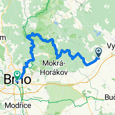
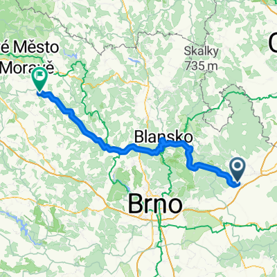
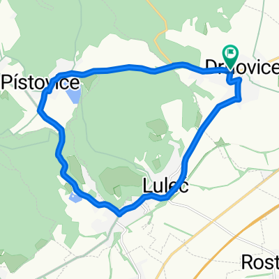
Vyškov - Křtiny - Brno
A cycling route starting in Drnovice, South Moravian, Czechia.
Overview
About this route
15.06.2002 Vyškow - Luleč - Habrovany - Olšany - U Tří javorů - Háděk - Křtiny - Křtinské údolí - Josefovské údolí - Huť Františka - Adamov - Bíloviče nad Svitavou - Brno-Obřany - Brno, main station
- -:--
- Duration
- 55.1 km
- Distance
- 1,213 m
- Ascent
- 1,269 m
- Descent
- ---
- Avg. speed
- 538 m
- Max. altitude

Route quality
Waytypes & surfaces along the route
Waytypes
Road
23.7 km
(43 %)
Track
11.6 km
(21 %)
Surfaces
Paved
46.3 km
(84 %)
Unpaved
3.3 km
(6 %)
Asphalt
46.3 km
(84 %)
Gravel
2.2 km
(4 %)
Continue with Bikemap
Use, edit, or download this cycling route
You would like to ride Vyškov - Křtiny - Brno or customize it for your own trip? Here is what you can do with this Bikemap route:
Free features
- Save this route as favorite or in collections
- Copy & plan your own version of this route
- Sync your route with Garmin or Wahoo
Premium features
Free trial for 3 days, or one-time payment. More about Bikemap Premium.
- Navigate this route on iOS & Android
- Export a GPX / KML file of this route
- Create your custom printout (try it for free)
- Download this route for offline navigation
Discover more Premium features.
Get Bikemap PremiumFrom our community
Other popular routes starting in Drnovice
 Vyškov - Křtiny - Brno
- Distance
- 55.1 km
- Ascent
- 1,213 m
- Descent
- 1,269 m
- Location
- Drnovice, South Moravian, Czechia
 Luleč - Jedovnice - Šiklův mlýn
- Distance
- 83.2 km
- Ascent
- 1,415 m
- Descent
- 1,205 m
- Location
- Drnovice, South Moravian, Czechia
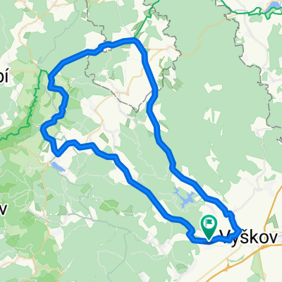 60 km - Drahanská vrchovina
- Distance
- 63.9 km
- Ascent
- 640 m
- Descent
- 639 m
- Location
- Drnovice, South Moravian, Czechia
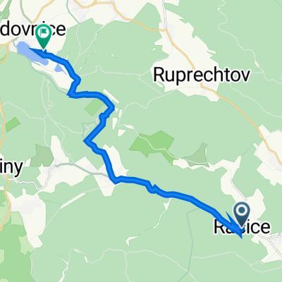 Račice 71, Račice-Pístovice to Jedovnice E169, Jedovnice
- Distance
- 14.4 km
- Ascent
- 364 m
- Descent
- 212 m
- Location
- Drnovice, South Moravian, Czechia
 MVG6500
- Distance
- 6,415.3 km
- Ascent
- 93,115 m
- Descent
- 93,114 m
- Location
- Drnovice, South Moravian, Czechia
 Malý okruh
- Distance
- 12.7 km
- Ascent
- 187 m
- Descent
- 186 m
- Location
- Drnovice, South Moravian, Czechia
 Do práce
- Distance
- 6.5 km
- Ascent
- 40 m
- Descent
- 26 m
- Location
- Drnovice, South Moravian, Czechia
 XC s lesními traily
- Distance
- 38 km
- Ascent
- 695 m
- Descent
- 697 m
- Location
- Drnovice, South Moravian, Czechia
Open it in the app